

Aerial Photo Maps of Alameda County, CA
|
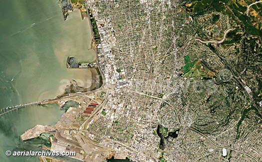
Aerial Archives maintains an extensive library of vertical photography of Alameda County, CA, including and historical and current aerial photography and creates custom aerial photography on assignment. For oblique at an angle aerial photography of Alameda, please consult aerial photographs of Alameda county. Available imagery includes georeferenced aerial photography of all of Alameda County or any customized portion, including aerial photographs of Alameda, Albany, Berkeley, Dublin, Emeryville, Fremont, Hayward, Oakland, Newark and San Leandro delivered both as prints and in digital form. Specialized services include delivery of geotiffs, customized labelling of aerial maps and output to specialized media. The aerial photography of coverage of aerial maps of Alameda County can also be completely customized both with respect to scale and to show the entire city or metropolitan area or only a set of blocks. For current aerial photography coverage of Alameda county, California please contact us. The aerial photo map of the Emeryville and Oakland in Alameda County, California shown above is available for immediate online license or prints or, to obtain it optimized to your needs please contact Aerial Archives directly and reference the ID number in the caption to the photograph.
|
|
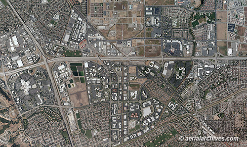
High resolution vertical and oblique aerial photographs are available of the Hacienda Business Park and adjacent areas in Pleasanton, California. To obtain the aerial photo map of the city of Hacienda Business Park in Pleasanton, Alameda County, California shown above please contact Aerial Archives directly and reference the ID number in the caption to the photograph.
|
|
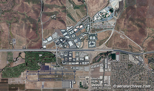
High resolution vertical and oblique aerial photographs are available of the Livermore Airport Business Center and adjacent areas in Livermore, California. To obtain the aerial photo map of the Livermore Airport Business Center, Alameda County, California shown above please contact Aerial Archives directly and reference the ID number in the caption to the photograph.
|
|
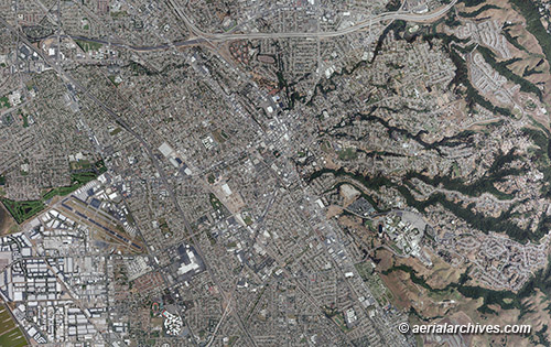
High resolution vertical and oblique aerial photographs are available of the city of Hayward, the Hayward fault and adjacent areas in Hayward, California. To obtain the aerial photo map of the Hayward, Alameda County, California shown above please contact Aerial Archives directly and reference the ID number in the caption to the photograph.
|
|
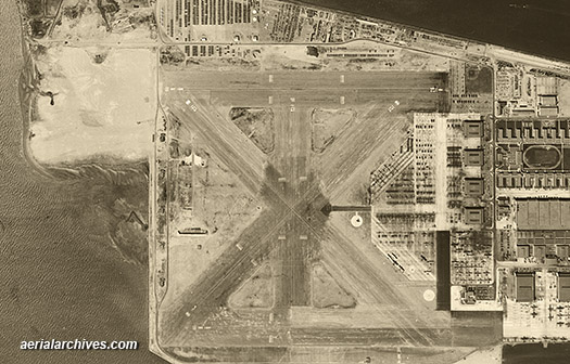
Historical aerial photographs of Alameda county are available for numerous years. For historical aerial photography of Alameda county, we recommend that you use the pdf research request form. Additional information about obtaining historical aerial photography of Alameda County is also available at aerial photography research and at aerial photography research FAQs. For additional information about aerial photography of Alameda, please contact us. The historical aerial photo of the Naval Air Station, Alameda a shown above is available for immediate online license or prints or, to obtain it optimized to your needs please contact Aerial Archives directly and reference the ID number in the caption to the photograph.
|