

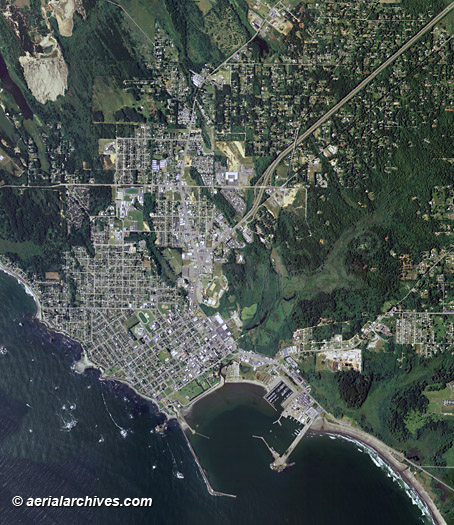
An extensive selection of aerial maps, aerial photographs and satellite imagery of Del Norte County, California is available Aerial Archives, as well as oblique aerial photography. Available imagery includes georeferenced aerial photography and satellite imagery of Del Norte county delivered both as prints and digital files. Specialized services include delivery of geotiffs, customized labelling of aerial maps and output to specialized media. The coverage of aerial maps of Del Norte county can also be completely customized both with respect to scale and to show the county or only a specific community. Aerial map coverage includes Fort Dick, Gasquet, Hiouchi, Klamath, Patrick Creek, Douglas Park, Darlingtonia, and Smith River. For current aerial photography and satellite imagery coverage of Del Norte county, California please contact us.
|
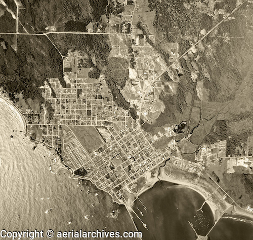
Historical Aerial Photography of Del Norte County
|
Aerial Archives also provides high resolution historical aerial photography for all portions of Del Norte County, California. This historical aerial map of Crescent City, Del Norte County, California shown above is available for immediate online license or prints or, to obtain a large file or this image optimized to your needs please contact Aerial Archives directly and reference the ID number in the caption to the photograph. For historical research of aerial photography and satellite imagery of Del Norte county, California we recommend that you use the research request form. Additional information about the process of researching historical aerial photography and satellite imagery for your location is available at aerial photography research. |