

Aerial Photo Maps and Satellite Imagery of Fresno, California
Fresno Aerial Photographs For Immediate Download
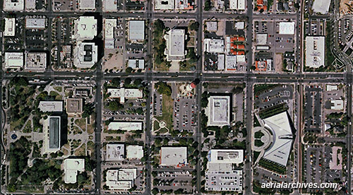
An extensive selection of vertical aerial photography of the city and county of Fresno, CA, including aerial photo maps and satellite imagery of Fresno, and historical and current aerial photography is available from Aerial Archives. Available imagery includes georeferenced aerial photography of the city and county of Fresno delivered both as prints and in digital form. Specialized services include delivery of geotiffs, customized labelling of aerial photo maps and output to specialized media. The aerial of coverage of aerial photo maps of City of Fresno can also be completely customized both with respect to scale and to show the county or only a specific community. For current aerial photography and satellite imagery coverage of Fresno, California please contact us. The aerial photo map of Fresno, California shown on this page is available for immediate online license or prints or, to obtain it optimized to your needs or as a higher resolution file please contact Aerial Archives directly and reference the ID number in the caption to the photograph.
|
|
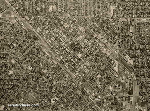
Historical aerial photographs of Fresno county are available for numerous years. Historical coverage for the city of Fresno includes 1946, 1962, 1965, 1970, 1972, 1975 and numerous additional dates including very recently acquired imagery For historical research of aerial photography and satellite imagery of City of Fresno, California we recommend that you use the research request form. Additional information about the process of researching historical aerial photography and satellite imagery for your location is available at aerial photography research. The historical aerial photo of Fresno, California shown on this page is available for immediate online license or prints or, to obtain it optimized to your needs or as a higher resolution file please contact Aerial Archives directly and reference the ID number in the caption to the photograph.
|