

Aerial Photo Maps and Satellite Imagery of Las Vegas
Clark County, Nevada
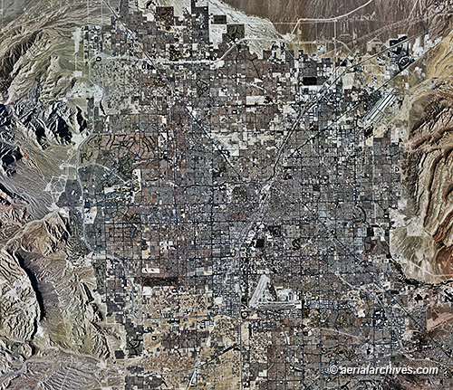
An extensive selection of high resolution vertical aerial photography (aerial photo maps) and satellite imagery of Las Vegas and other parts of Clark County, Nevada, is available from Aerial Archives, including current and historical aerial photography. Available imagery includes georeferenced aerial photography and satellite imagery of Las Vegas, Nevada and the rest of Clark county. The aerial photo maps of Las Vegas, Nevada or other parts of Clark county can be completely customized both with respect to scale and to show the county or only a specific community. To obtain the aerial photo map of the city of Las Vegas, Nevada shown above please contact Aerial Archives directly and reference the ID number in the caption to the photograph.
|
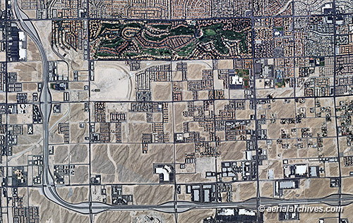
Also available are aerial photo maps of specific neighborhoods, districts or sections of Las Vegas. For information about historical aerial photography of Las Vegas to document changes over time, please visit To obtain the aerial photo map of the edge of development along highway 215 in Las Vegas, Nevada shown above please contact Aerial Archives directly and reference the ID number in the caption to the photograph.
|
Aerial Archives provides recent, high resolution vertical aerial photography of Las Vegas, Nevada.
|
|
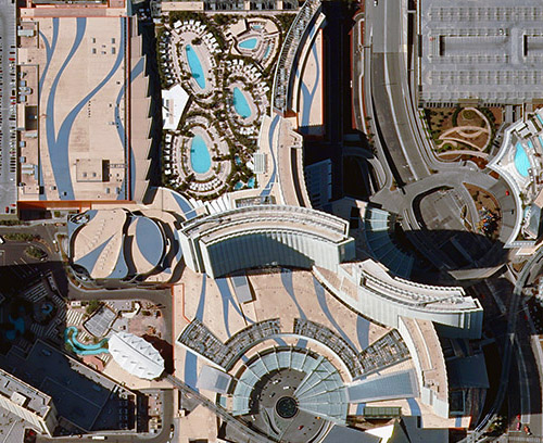
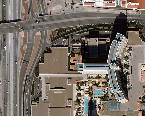
To obtain the detailed aerial photo maps of Las Vegas, Nevada shown above please contact Aerial Archives directly and reference the ID number in the caption to the photograph. For current aerial photography and satellite imagery coverage of Las Vegas and other parts of Clark County Nevada please contact us. To obtain historical aerial photography of Las Vegas, Nevada we recommend that you use the research request form. Additional information about the process of researching historical aerial photography for your location is available at aerial photography research. Aerial photographs of Las Vegas, Nevada available for immediate download or prints are available at aerial photographs of Las Vegas. |