

Aerial Photo Maps and Satellite Imagery of Los Angeles, California
Aerial Maps of Los Angeles For Immediate Download
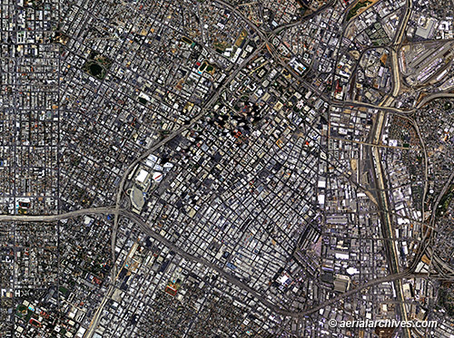
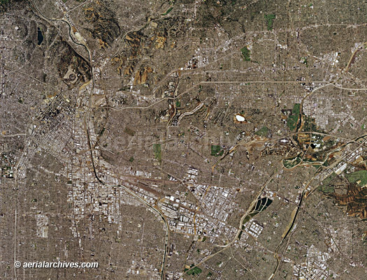
An extensive selection vertical aerial photography and satellite imagery of Los Angeles, California, including aerial photo maps of Los Angeles, and historical and current aerial photography. Available imagery includes orthorectified aerial photography and satellite imagery of Los Angeles delivered both as prints and in digital form. Specialized services include delivery of geotiffs, customized labelling of aerial photo maps and output to specialized media. The aerial of coverage of aerial photo maps and satellite imagery of Los Angeles can also be completely customized both with respect to scale and to show the entire city or metropolitan area or only a set of blocks. Current aerial photo maps of the entire City and County of Los Angeles, CA are available for numerous years including very recently acquired high resolution satellite imagery. The aerial photograph of Los Angeles shown above from at full resolution can be enlarged to a height of 9 feet. Aerial Archives also provides aerial photo maps showing the same area which would enlarge up to a height of 30 feet for the same area. Available imagery includes georeferenced aerial photography and satellite imagery of all of Los Angeles County, California or any customized portion. The aerial photo map of Los Angeles, California shown above is available for immediate online license or prints, or to obtain this aerial photo map at a larger file size suitable for very large displays, or optimized to your specific specifications please contact Aerial Archives directly.
|
Aerial Photo Maps and Satellite Imagery of Port of Los Angeles, CA
|
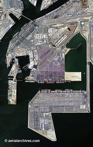
The aerial photo map of the Port of Los Angeles, California shown above is available for immediate online license or prints, or to obtain this aerial photo map at a larger file size suitable for very large displays, or optimized to your specific specifications please contact Aerial Archives directly.
|
|
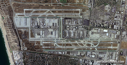
High resolution aerial photo maps and satellite imagery are available for all of the Los Angeles airports. The aerial photo map of the Los Angeles International Airport shown above is available for immediate online license or prints, or to obtain this aerial photo map at a larger file size suitable for very large displays, or optimized to your specific specifications please contact Aerial Archives directly.
|
|
High resolution aerial photo maps and satellite imagery are available for all of the communities in Los Angeles county, including aerial photo maps of
Brentwood,
Burbank,
Century City,
Chatsworth,
Culver City,
El Segundo,
Glendale,
Hawthorne,
Hermosa Beach,
Huntington Park,
Lancaster,
Long Beach,
Malibu,
Manhattan Beach,
Marina del Rey,
Pasadena,
Santa Monica and
Van Nuys.
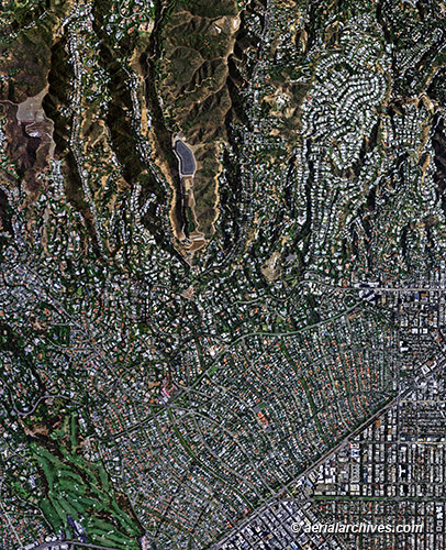
The aerial photo map of Beverly Hills, California shown above is available for immediate online license or print, or to obtain this aerial photo map at a larger file size suitable for very large displays, or optimized to your specific specifications please contact Aerial Archives directly.
|
|
The aerial photo map of Los Angeles, California shown above is available for immediate online license or prints, or to obtain this aerial photo map at a larger file size suitable for very large displays, or optimized to your specific specifications please contact Aerial Archives directly. For current vertical aerial photography and satellite imagery coverage of Los Angeles, California please contact us. For historical research of aerial photography and satellite imagery of Los Angeles we recommend that you use the research request form. Additional information about the process of researching historical aerial photography and satellite imagery for Los Angeles is available at aerial photography research. Some historical aerial photographs of Los Angeles can also be viewed and downloaded immediately or ordered as prints at historical aerial photographs of Los Angeles.
|