

Aerial Maps and Satellite Imagery of Napa Valley, CA
An extensive selection of aerial maps, vertical (straight down) aerial photography and satellite imagery of Napa Valley, CA, including historical and current aerial photography. Available imagery includes georeferenced and orthorectified aerial photography of Napa Valley delivered both as prints and as digital files. Maps include each of the cities and towns in Napa Valley including: American Canyon; Angwin; Calistoga; Deer Park; Imola; Middleton; the City of Napa; Napa Junction; Napa Soda Springs; Oak Knoll; Oakville; Pope Valley; Rutherford; Saint Helena and Yountville. In addition to aerial maps and satellite imagery, the Aerial Archives library also includes an extensive collection of oblique (at an angle) aerial photography of Napa county and the Napa Valley. |
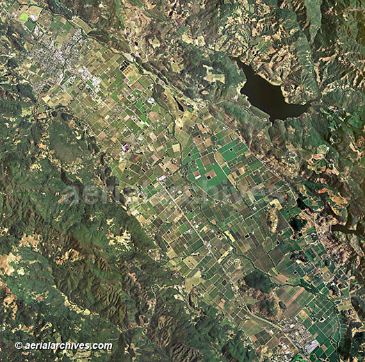
Aerial Map of a Portion of Napa Valley, CA
|
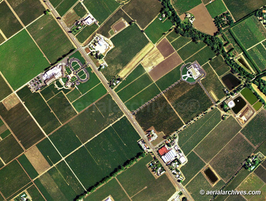
Current aerial maps of the entire county are available for numerous years with high resolution satellite imagery available that is sometimes only a few weeks old. The aerial photograph shown above at full resolution would enlarge to 9 feet across. Higher resolution aerial photography showing the same area could enlarge up to a maximum resolution of 30 feet across. Aerial Archives has produced a number of very large aerial murals for clients. A large aerial mural turns an office wall into a unique and often power visual communications tool. The photograph below shows a small section of the larger view shown above.
The aerial map of the Napa Valley shown above is available for immediate online license or prints, or to obtain this image at a larger file size suitable for very large displays, or optimized to your specific specifications please contact Aerial Archives directly.
|
|
This aerial map gives an idea of the level of detail which is obtained at one meter pixel resolution. High resolution satellite imagery and high resolution aerial photography will provide even greater resolution. Aerial maps of this seamless imagery are available for the entire county, or for only a small area customized to your needs.
|
|
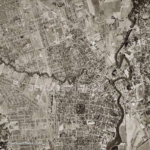
Complete historical aerial photography coverage of the entire county of Napa, CA is available from numerous years including 1958 with a scale of 1:20,000 and numerous other years, including extensive infrared and color aerial photography coverage. Specialized services include delivery of geotiffs, customized labelling of aerial maps and output to specialized media. The aerial of coverage of aerial maps of Napa Valley can also be completely customized both with respect to scale and to show the entire city or metropolitan area or only a set of blocks. For current aerial photography and satellite imagery coverage of Napa County, California please contact us. For historical research of aerial photography of Napa County, California we recommend that you use the pdf research request form. Additional information about the process of researching historical aerial photography for your location is available at aerial photography research.
|