Aerial Photo Maps and Satellite Imagery of Portland, Oregon
Aerial Photographs of Portland, Oregon for Immediate Download
Aerial Photographs of Oregon for Immediate Download
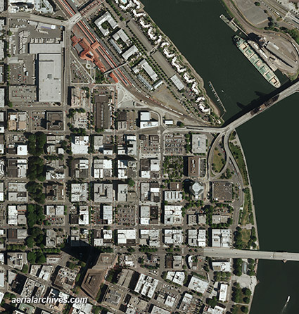
An extensive selection of vertical aerial photography of Portland, Oregon, including aerial photo maps and satellite imagery of Portland, historical and current aerial photography is available from Aerial Archives. Available imagery includes georeferenced aerial photography of Portland. A selection of Portland, Oregon aerial photography is available for immediate download at Aerial Photographs of Portland, Oregon. The coverage of aerial photo maps of City of Portland can also be completely customized both with respect to scale and to show the county or only a specific community. The aerial photo map of Portland, Oregon shown above is available for immediate online license or prints, or to obtain this image optimized to your specification, please contact Aerial Archives directly. For current aerial photography and satellite imagery coverage of Portland or other portions of Oregon please contact us.
|
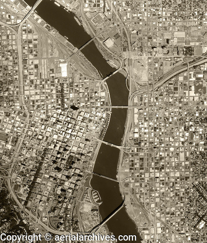
Historical Aerial Photographs of Portland, Oregon
Aerial Archives provides in depth historical aerial photography and satellite coverage of Portland, Oregon. The historical aerial photograph of Portland, Oregon shown on this page is available for immediate online license or prints or, to obtain it optimized to your needs or as a higher resolution file please contact Aerial Archives directly and reference the ID number in the caption to the photograph. For historical aerial photography of Portland, Oregon we recommend that you use the pdf research request form. Additional information about obtaining existing aerial photography of Portland, Oregon is also available at aerial photography research and at aerial photography research FAQs. |