

Aerial Photographs of the California Central Valley for Immediate Download
Aerial Archives maintains an extensive library of vertical photography of San Joaquin county, CA, including historical and current aerial photography and is available to create custom vertical aerial photograph of San Joaquin county. Available imagery includes georeferenced aerial photography of San Joaquin county delivered both as prints and in digital form. Included are complete aerial photography of each of the cities in the county including aerial maps of August, Country Club, Escalon, Farmington, French Camp, Garden Acres, Kennedy, Lathrop, Lincoln Village, Linden, Lockeford, Lodi, Manteca, Morada, Mountain House, North Woodbridge, Ripon, South Woodbridge, Stockton, Taft Mosswood and Tracy. Specialized services include delivery of geotiffs, customized labelling of aerial maps and output to specialized media. The aerial of coverage of aerial maps of San Joaquin County can also be completely customized both with respect to scale and to show the county or only a specific community.
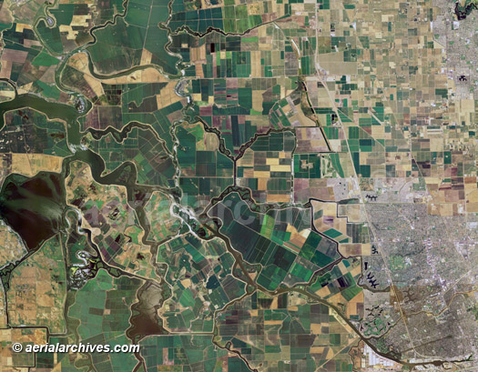
The aerial map of San Joaquin county, CA shown above is available for immediate online license or prints, or to obtain this image at a larger file size suitable for very large displays, or optimized to your specific specifications please contact Aerial Archives directly.
|
|
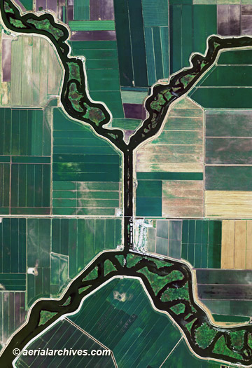
The aerial map of a detailed view of agriculture, levees and water channels at Kings Island in San Joaquin county, CA shown above is available for immediate online license or prints, or to obtain this image at a larger file size suitable for very large displays, or optimized to your specific specifications please contact Aerial Archives directly. For current aerial photography coverage of San Joaquin county, California or to have custom aerial photography created, please contact us.
For historical research of aerial photography of San Joaquin County, California we recommend that you use the research request form. Additional information about the process of researching historical aerial photography for your location is available at aerial
photography research.
|