

Aerial Maps of San Luis Obispo County, CA
Aerials Photographs of San Luis Obispo Available for Immediate License
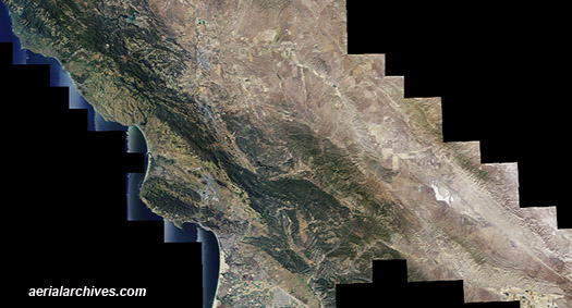
Aerial Archives maintains an extensive library of vertical photography of San Luis Obispo County, CA, including aerial maps of San Luis Obispo County, and historical and current aerial photography. Available imagery includes georeferenced and orthorectified aerial photography of San Luis Obispo County delivered both as prints and in digital form. The collection includes seamless georeferenced aerial photography of the entire county and seamless aerial maps of individual communities and geographic features in San Luis Obispo County, including: Arroyo Grande, Atascadero, Avila Beach, Baywood Park, Cambria, Cayucos, Cholame, Creston, Estrella, Grover Beach, Harmony, Lake Nacimiento, Los Osos, Morro Bay, Nipomo, Oceano Paso Robles, Pismo Beach, Pozo, San Luis Obispo, San Miguel, San Simeon, Santa Margarita, Shandon, Simmler and Templeton.
|
|
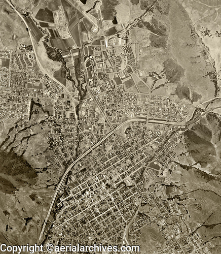
The aerial photograph of San Luis Obispo, California shown above is available for immediate online license or prints, or to obtain this image optimized to your specific specifications please contact Aerial Archives directly. For current aerial photography coverage of San Luis Obispo County, California please contact us. For historical research of aerial photography of San Luis Obispo County, California we recommend that you use the research request form. Additional information about the process of researching historical aerial photography for your location is available at aerial photography research.
|