

Aerial Photographs of Santa Cruz County for Immediate Download
|
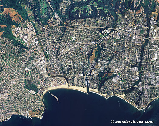
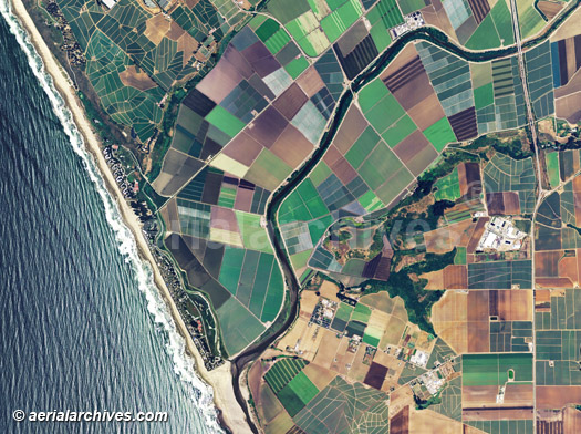
An extensive selection of vertical aerial photography and satellite imagery of Santa Cruz County, CA, is available from Aerial Archives including and historical and current aerial photography of Santa Cruz county. Available imagery includes orthorectified aerial photography and satellite imagery of Santa Cruz County delivered both as prints and in digital form. Specialized services include delivery of geotiffs, customized labelling of aerial maps and output to specialized media. The coverage of aerial maps of Santa Cruz County can also be completely customized both with respect to scale and to show an entire city, the complete county or only a set of blocks. Among the cities and towns included in the collection are Capitola, Santa Cruz, Scotts Valley, Watsonville, Amesti, Aptos, Aptos Hills-Larkin Valley, Ben Lomond, Bonny Doon, Boulder Creek, Brookdale, Corralitos, Davenport, Day Valley, Felton, Freedom, Interlaken, La Selva Beach, Live Oak, Mount Hermon, Opal Cliffs, Rio del Mar, Soquel, Pasatiempo and Twin Lakes. Aerial Archives also maintains an extensive collection of oblique (at an angle) aerial photography of Santa Cruz county and is available create custom aerial photography of any location in the county. For additional information about the oblique aerial collection please visit aerial photographs of Santa Cruz county. The aerial map of Santa Cruz, California shown on this page is available for immediate online license or prints or, to obtain it optimized to your needs or as a higher resolution file please contact Aerial Archives directly and reference the ID number in the caption to the photograph. To request a custom flight to create an aerial map of Santa Cruz or for aerial photography and satellite imagery coverage of Santa Cruz county, California please contact us.
|
|
The aerial map of Santa Cruz, California shown on this page is available for immediate online license on prints or, to obtain it optimized to your needs or as a higher resolution file please contact Aerial Archives
directly and reference the ID number in the caption to the photograph. Additional aerial photographs of Santa Cruz County are available for immediate download or prints. To request a custom flight to create an aerial map of Santa Cruz or for current aerial map and aerial photography coverage of Santa Cruz county, California please contact us. For historical research of aerial photography and satellite imagery of Santa Cruz County, California we recommend that you use the research request form. Additional information about the process of researching historical aerial photography for your location is available at aerial photography research.
|