

Aerial Maps of Solano County For Immediate Download
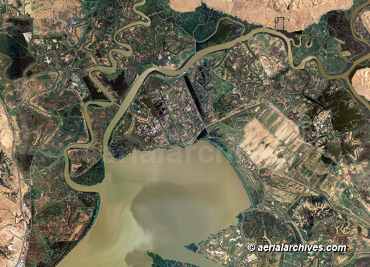
An extensive selection of vertical aerial photography and satellite imagery of Solano county, California is available from Aerial Archives, including aerial maps of Solano county and historical and current aerial photography. Available imagery includes georeferenced aerial maps and and satellite imagery of Solano county, CA delivered both as prints and in digital form. Among the communities included in this collection of aerial photography and satellite imagery are Benicia, Davis, Fairfield, the Solano county farmlands, Grizzley bay, Mare island, Rio Vista, Suisan marsh, Vacaville, and Vallejo. Specialized services include delivery of geotiffs, customized labelling of aerial maps and output to specialized media. The aerial photography coverage and aerial maps of Solano county can also be completely customized both with respect to scale and to show the entire county or a specific metropolitan area or only a set of blocks. The aerial photograph of solar panel installation at the wastewater treatment plant shown above is available for immediate online license or prints, or to obtain this image optimized to your specifications, please contact Aerial Archives directly. For current aerial photography and satellite imagery coverage of Solano County, California please contact us. For historical research of aerial photography and satellite imagery of Solano County, California we recommend that you use the research request form. Additional information about the process of researching historical aerial photography for your location is available at aerial photography research. Additional information about obtaining stock aerial photography is also available at aerial photography research and at aerial photography research FAQs.
|