

Aerial Photography of El Paso, Texas
Aerials Photographs of El Paso Available for Immediate License
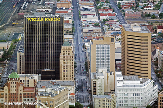
| A broad and diverse selection of stock aerial photographs of El Paso, Texas is represented in the aerial photography library of Aerial Archives. This includes oblique aerial photographs of El Paso including aerial views of downtown El Paso, the Rio Grande river and the US-Mexican border, and the major freeways, buildings and geographic features. In addition to oblique aerial photography of El Paso, a comprehensive color vertical (straight down) aerial photography coverage of the entire El Paso, Texas metropolitan area is available. The archive also contains a large collection of historical stock aerial photography of El Paso, including a comprehensive collection of vertical El Paso aerial photographs dating back to the 1940s, and includes aerial photos of El Paso area in El Paso county both in color and black and white, with coverage approximately every ten years. The aerial photograph of downtown El Paso, Texas shown above is available for immediate online license or prints, or to obtain this image optimized to your specific specifications please contact Aerial Archives directly.
|
|
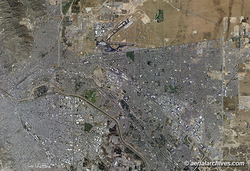
Aerial Archives also delivers aerial maps and satellite imagery of El Paso, Texas and the rest of Texas as well as historical aerial maps of Texas. For information about aerial maps of Ciudad Juárez, please visit Aerial Maps of Ciudad Juarez. The aerial map of the El Paso, Texas and Ciudad Juárez, Mexico shown above is available for immediate online license or prints or, to obtain it optimized to your needs please contact Aerial Archives directly and reference the ID number in the caption to the photograph.
|
|
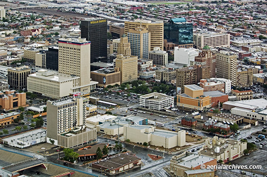
The aerial photograph of El Paso, Texas shown above is available for immediate online license or prints, or
to obtain this image optimized to your specific specifications please contact Aerial Archives directly.
|
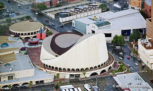
Aerial Photographs of Chavez Theatre and Museum of Art, El Paso Texas
|
The aerial photograph of the Abraham Chavez Theatre and El Paso Museum of Art shown above is available for immediate online license or prints, or
to obtain this image optimized to your specific specifications please contact Aerial Archives directly.
|
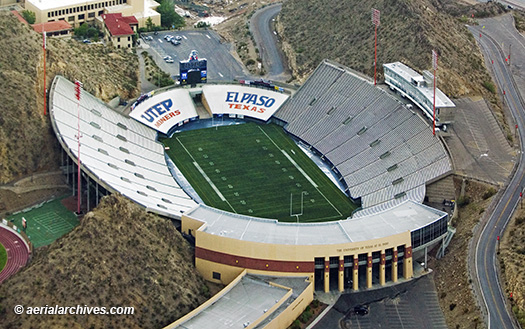
Sun Bowl Stadium, Univerity of Texas, El Paso Aerial Photograph
|
The aerial photograph of the Sun Bowl Stadium, University of Texas, El Paso shown above is available for immediate online license or prints, or
to obtain this image optimized to your specific specifications please contact Aerial Archives directly.
|
|
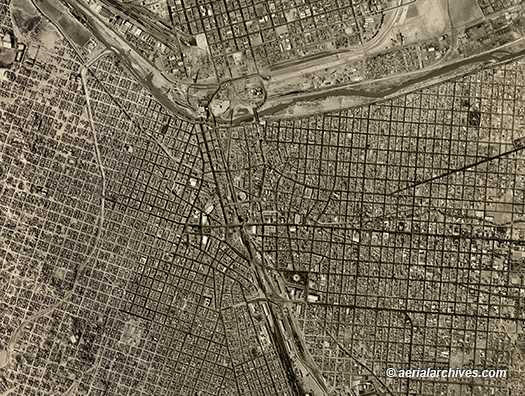
Aerial Archives provides historical aerial photography of El Paso and other parts of Texas as well as coverage of Ciudad Juarez, Mexico. For historical aerial photography we recommend that you use the research request form. Additional information about obtaining existing aerial photography is also available at aerial photography research and at aerial photography research FAQs. The historical aerial photograph of El Paso, Texas and Ciudad Juarez shown above is available for immediate online license or prints, or to obtain this image optimized to your specific specifications please contact Aerial Archives directly. For specific requests for El Paso, Texas aerial photography not shown on this site, please contact Aerial Archives directly. |