

Aerial Photographs Of Lake County, California
Aerial Photographs of Lake County for Immediate Download
|
An extensive selection of aerial photographs of Lake county, California is represented in the library of Aerial Archives, including extensive coverage of the world's largest geothermal power plant cluster, most of which are operated by Calpine corporation. Included in the aerial photography collection are oblique aerials of Lake county, California including the entire periphery of Clear Lake, and views of each of the individual cities and townships of Lake county, California. To view aerial photographs of Lake County, California available for immediate online license or prints, please consult Lake County aerial photographs. Among the aerial photographs included in this collection of aerial photography are aerials of Clearlake, Clearlake Oaks, Cobb, Finley, Glenhaven, Kelseyville, Lakeport, Loch Lomand, Lower Lake, Lucerne, Middletown, Nice, Upper Lake and Witter Springs.The archive also contains a comprehensive collection of vertical (straight down) aerial photographs of Lake county, California. For additional information please consult aerial maps of Lake County.
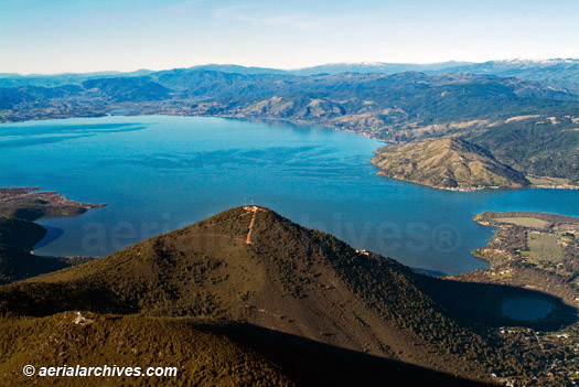
The aerial photograph of Mount Konocti, the volcano on the shores of Clear Lake and Clear Lake in Lake County, CA shown above is available for immediate online license, or to obtain this image optimized to your specific specifications please contact Aerial Archives directly.
|
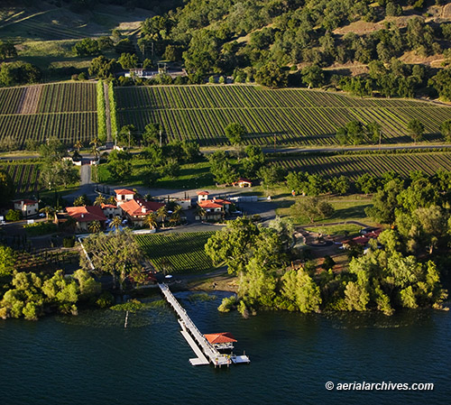
Aerial Photograph Of Ceago Vinegarden
|
The aerial photography collection includes numerous photographs of the vineyards and wineries in Lake County. The aerial photograph of the Ceago Estate, former Ceago Winery and Biodynamic Farm on Clear Lake in Nice, California shown above is available for immediate online license or prints, or to obtain this image optimized to your specific specifications please contact Aerial Archives directly.
|
|
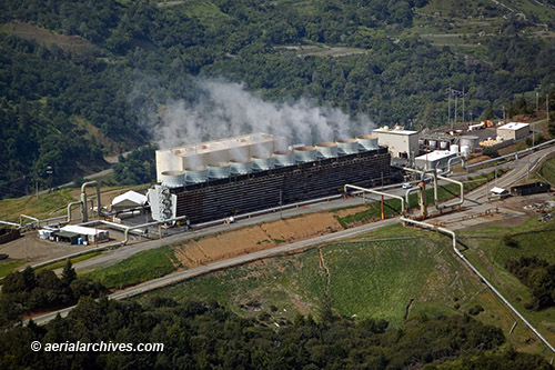
The Geysers is the largest complex of geothermal power plants in the world. It consists of 22 geothermal power plants in the Mayacamas Mountains. Calpine Corporation owns and operates 19 of the plants. The steam used to generate power is produced from a greywacke standstone reservoir. The source of the heat is a large magma chamber over 4 miles under ground. The aerial photograph of the geothermal power plant in the Mayacamas Mountains of California shown above is available for immediate online license, or to obtain this image optimized to your specific specifications please contact Aerial Archives directly.
|
|
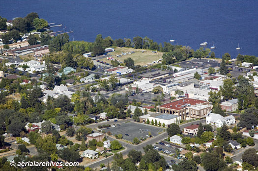
The aerial photograph of the Lakeport, California which is the county seat of Lake County, California shown above is available for immediate online license or prints, or
to obtain this image optimized to your specific specifications please contact Aerial Archives directly.
|
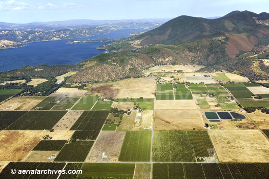
|
The aerial photograph of the Kelseyville, CA Vineyards and Mt. Konocti shown above is available for immediate online license or prints, or
to obtain this image optimized to your specific specifications please contact Aerial Archives directly. For aerial maps or vertical aerial photography or historical aerial photography of Lake County, please consult aerial maps of Lake County.
To obtain historical aerial photograph of Lake county not shown on this site, please use the pdf research request form. Additional information about obtaining historical stock aerial photography is also available at aerial photography research and at aerial photography research FAQs. Each year a gathering of seaplanes participates in the Clear Lake Splash-In held in Lakeport, California. Photographs of the Splash in created by Aerial Archives can be viewed at Clear Lake Splash In. |