

Aerial Photographs of Nicaragua
Español
Aerials Photographs of Nicaragua Available for Immediate License
|
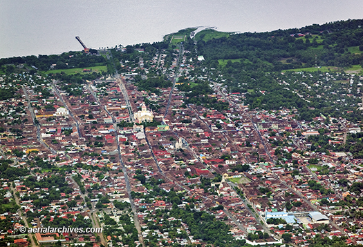
An extensive selection of aerial photography and satellite imagery of Nicaragua is available from Aerial Archives. This collection of aerial photography includes oblique aerials of Managua. The archive also contains a comprehensive collection of vertical aerial photography and satellite imagery of Managua and other parts of Nicaragua. For additional aerial photographs of Nicaragua available for immediate online license or prints, please consult aerial photographs of Nicaragua. The aerial photograph of Granada, Nicaragua shown above is available for immediate online license or prints or, to obtain it optimized to your needs please contact Aerial Archives directly and reference the ID number in the caption to the photograph.
|
|
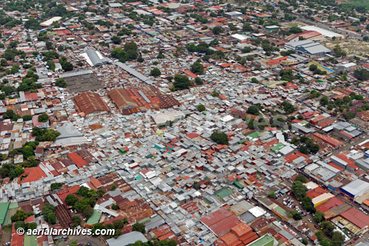
Numerous aerial photographs of Managua, Nicaragua are available from Aerial Archives. The aerial photograph of Managua, Nicaragua shown above is available for immediate online license or prints or, to obtain it optimized to your needs please contact Aerial Archives directly and reference the ID number in the caption to the photograph.
|
|
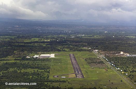
The aerial photograph of Augusto C. Sandino International Airport, Managua, Nicaragua shown above is available for immediate online license or prints or, to obtain it optimized to your needs please contact Aerial Archives
directly and reference the ID number in the caption to the photograph. For specific requests for Nicaragua aerial and satellite photography please contact Aerial Archives. directly |