

Marin County Aerial Photographs For Immediate Download
Historical Aerial Photographs of Marin County for Immediate Download
|
Aerial Archives creates custom aerial photography of all parts of Marin county, California and its library contains an extensive selection of aerial photographs of Marin county, California is represented in the library of Aerial Archives. To view aerial photographs of Marin County available for immediate online license, please consult aerial photographs of Marin. This collection includes oblique aerials of the entire Marin county including views of each of the individual cities and townships of Marin county. Among the aerial photographs included in this collection of aerial photography are aerials of:
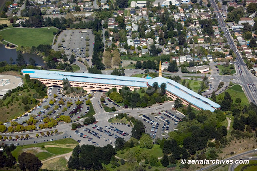
Belvedere, The archive also contains a comprehensive collection of vertical (straight down) Marin county aerial photography including aerial photos of Marin County both in color, infrared and black and white. For additional details please consult aerial maps of Marin County. The aerial photograph of the Marin Civic Center designed by Frank Lloyd Wright shown above is available for immediate online license or prints. Aerial Archives will also deliver this image optimized to your specific specifications, please contact Aerial Archives directly.
|
|
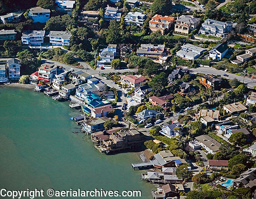
Aerial Archives library contains many aerial photographs of Belvedere properies and will also create aerial photography on assignment. The aerial photograph of Belvedere waterfront homes shown above is available for immediate online license or prints, or to obtain this aerial photograph optimized to your specifications, please contact Aerial Archives directly.
|
|
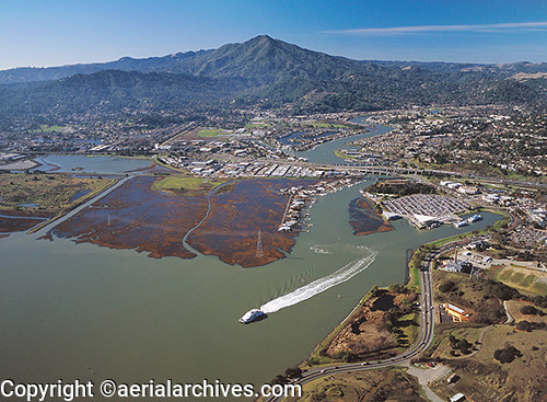
The aerial photograph of the Larkspur Ferry in Marin County with Mount Tamalpais in the background shown above is available for immediate online license or prints, or to obtain this aerial photograph optimized to your specifications, please contact Aerial Archives directly.
|
|
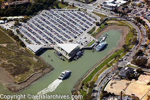
The aerial photograph of the full parking lot for commuters to San Francisco at the Larkspur Ferry in Marin County shown above is available for immediate online license or prints, or to obtain this aerial photograph optimized to your specifications, please contact Aerial Archives directly.
|
|
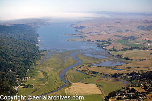
The aerial photograph of the San Andreas Fault at Tomales Bay in western Marin County, CA shown above is available for immediate online license or prints, or to obtain this aerial photograph optimized to your specifications, please contact Aerial Archives directly.
For custom aerial photography in Marin county or to obtain a specific aerial photograph of Marin county, CA not shown on this site, please contact us. For research of historical aerial photography please use the research request form.
Additional information about obtaining historical aerial photography of Marin is also available at aerial photography research and at aerial photography research FAQs.
|