

Aerial Photographs of Monterey County, CA
Monterey Aerial Photography For Immediate Download
|
A broad selection of aerial photographs of Monterey County is represented in the library of Aerial Archives. This includes oblique aerials of the entire Monterey County including views of each of the individual cities and townships of Monterey County. The archive also contains a comprehensive collection of vertical Monterey County aerial photography including aerial photographs of Monterey County both in color and black and white.
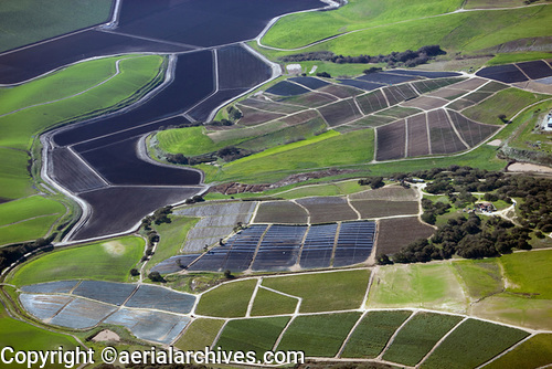
The aerial photograph of coastal farming between Watsonville and Salinas in Monterey County shown above is available for immediate online license or prints, or to obtain this image optimized to your specific specifications please contact Aerial Archives directly.
|
Aerial Photographs of Big Sur Available For Immediate Download
|
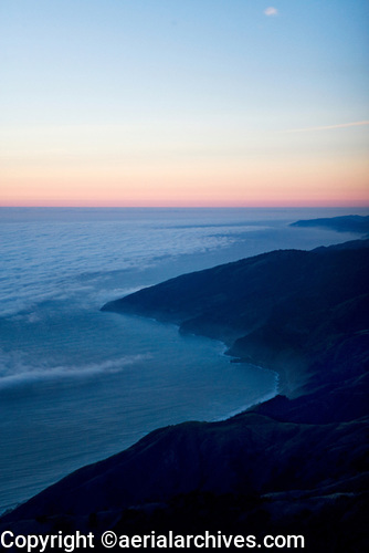
The aerial photograph of fog at the coast at Big Sur in Monterey County shown above is available for immediate online license or prints, or to obtain this image optimized to your specific specifications please contact Aerial Archives directly. Additional aerial photographs of Big Sur are available at Aerial Photographs of Big Sur Available For Immediate Download
|
|
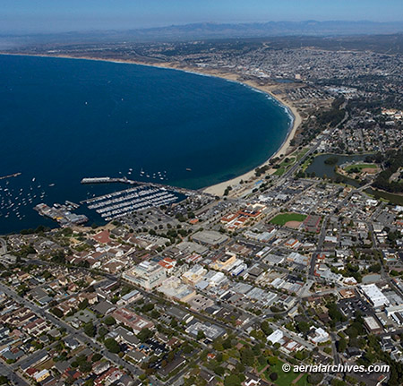
Aerial Archives has an extensive collection of aerial photography of the city of Monterey, California and shoots aerial photography of Monterey on assignment.
The aerial photograph of Monterey, California shown above is available for immediate license or prints. For specific requests for aerial photography of Monterey County and other portions of the California coastline, please contact Aerial Archives . |