

Aerial Photographs of New York City
New York Aerial Photography For Immediate Download
|
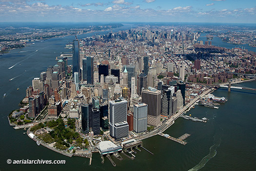
A large selection of aerial photography of New York city is represented in the library of Aerial Archives. To view thumbnails of aerial photographs of New York City available for immediate online license, please consult New York City aerials photographs. This collection of aerial photography includes oblique aerials of New York City including views of the Manhattan skyline, major buildings, bridges, harbors and piers, as well as coverage of Brooklyn, portions of Staaten Island, the Bronx and New Jersey. It includes aerial photographs of the Brooklyn, Williamsburg, Verrazzano and George Washington bridges, and the Hudson and East rivers. The archive also contains a comprehensive collection of vertical New York city aerial photographs and aerial maps covering the entire New York metropolitan area both in color and black and white and New York city aerial photography in infrared color for an entirely different look. The aerial photograph of New York City shown on this page is available for immediate online license or, to obtain it optimized to your needs please contact Aerial Archives directly and reference the ID number in the caption to the photograph.
|

|
The aerial photograph of midtown Manhattan and and the Empire State Building shown above is available for immediate online license or, to obtain it optimized to your needs please contact Aerial Archives directly and reference the ID number in the caption to the photograph.
|
|
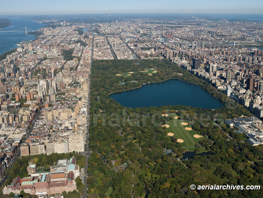
The aerial photograph of midtown Manhattan and Central Park shown above is available for immediate online license or, to obtain it optimized to your needs please contact Aerial Archives directly and reference the ID number in the caption to the photograph.
Current and historical vertical (straight down) aerial maps of New York city are also available. For additional information please consult aerial maps of New York.
To order a specific aerial photograph of New York city not shown on this site please contact us. For historical aerial photography of New York please consult historical aerial photography of New York. For historical aerial photography not shown on this site, we recommend that you use the research request form. Additional information about obtaining existing aerial photography of New York is also available at aerial photography research and at aerial photography research FAQs.
|