

Aerial Photographs of Palo Alto
Aerial Photographs of Palo Alto Available for Immediate Download
|
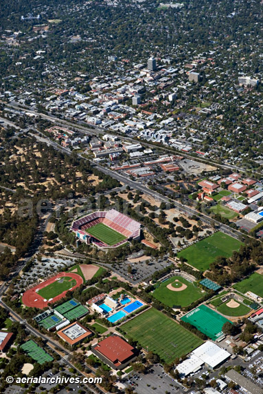
Aerial Archives creates custom aerial photography of Palo Alto, California and its library contains an extensive selection of aerial photographs of Palo Alto, California. This includes oblique aerials of the entire city limits of Palo Alto, CA including numerous aerial photographs of the Stanford University campus, the Palo Alto city hall, the Palo Alto airport, the major roads, intersections and other features. Additional aerial photographs of the Stanford University campus in Palo Alto, CA are available at aerial photographs of Stanford. The archive also contains a comprehensive collection of vertical aerial photography of Palo Alto including aerial photos of Palo Alto both in color and black and white. The aerial photograph of Stanford University and Palo Alto, CA shown on this page is available for immediate online license or prints. Aerial Archives will also deliver this image optimized to your specific specifications either as a digital file, or as a print, aerial mural, transparency or backlit display. To obtain customized service, please contact Aerial Archives directly. For custom aerial photography of Palo Alto or specific requests for Palo Alto aerial photography not shown on this site or to obtain aerial photographs optimized to your specific specifications please contact Aerial Archives. Additional related references include Aerial Photographs of Moffett Field and Aerial Photographs of Silicon Valley. Additional information about obtaining existing aerial photography is also available at aerial photography research and at aerial photography research FAQs. |