

Aerial Photographs Of Petaluma, California
Petaluma Aerial Photography For Immediate Download or Prints
Aerial Archives creates custom aerial photography of Petaluma, California and its library contains an extensive selection of aerial photographs of Petaluma, California. To view thumbnails of aerial photographs of Petaluma available for immediate online license and for prints, please consult aerials photographs of Petaluma.
This collection of aerial photography includes oblique aerials of the entire city limits of Petaluma and the surrounding areas, including views of each of the major roads, intersections, the Petaluma river, the Petaluma marsh and other wetlands, the turning basin and the marina, the Petaluma municipal airport and other features.
Photographs of the people at the Petaluma Municipal airport, aircraft that are based there and that visit, events that have taken place at the airport and business based there are available for review at Petaluma Municipal Airport.
The archive also contains a comprehensive collection of vertical aerial photography of Petaluma including aerial maps of Sonoma County.
For custom aerial photography of Petaluma, California or to obtain a specific stock aerial photograph of Petaluma, CA not shown on this site, please contact Aerial Archives directly.
For historical aerial photography of Petaluma we recommend that you use the
research request form.
Additional information about obtaining existing aerial photography of Petaluma is also available at
aerial photography research
and at
aerial photography research FAQs.
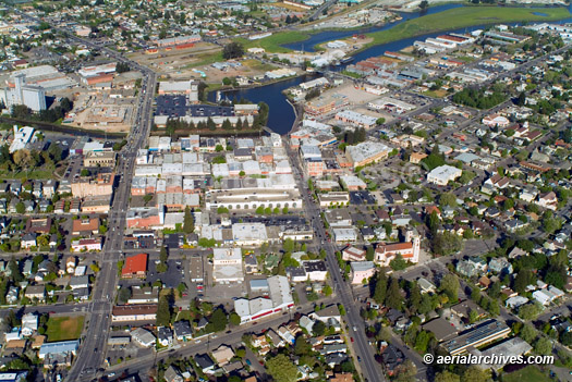
Historical aerial photograph of the center of
Petaluma, California, Sonoma County
2004
Image ID: AHLB3683
© Herb Lingl/aerialarchives.com
Terms of Image Use |
Immediate License or Print
Feedback
Petaluma, California
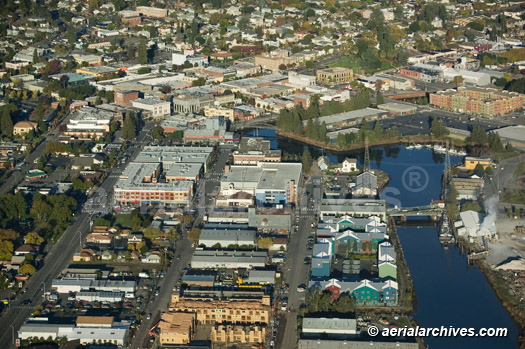
Image ID: AHLB4183
© Herb Lingl/aerialarchives.com
Terms of Image Use |
Immediate License or Print
Feedback
Petaluma Municipal Airport (O69)
The aerial photograph of downtown Petaluma, California shown above is available for immediate online license or printed to your specifications, or to obtain this image a digital file or mural optimized to your specifications, please contact Aerial Archives directly.
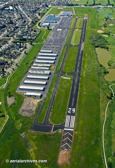
Petaluma, California
Image ID: AHLB3916
© Herb Lingl/aerialarchives.com
Terms of Image Use |
Immediate License or Print
Feedback
The aerial photograph of the Petaluma Municipal airport (O69), California shown above is available for immediate online license or print, or to obtain this image optimized to your specification, please contact Aerial Archives directly.