

Aerial Photographs and Photo Maps of Philadelphia, Pennsylvania
Aerial Photographs of Philadelphia Available for Immediate License
|
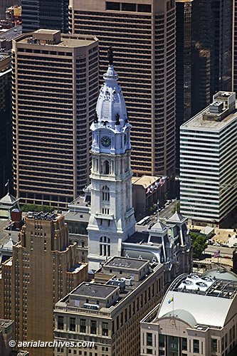
An extensive selection of aerial photographs and aerial maps of Philadelphia, Pennsylvania is available from Aerial Archives. This collection of aerial photography includes oblique aerials of the entire city limits of Philadelphia including views of each of the major roads, bridges, water front areas, intersections and other features. The aerial photograph shown above of City Hall in Philadelphia is available for immediate online license or prints or, to obtain it optimized to your needs please contact Aerial Archives directly and reference the ID number in the caption to the photograph.
|
|
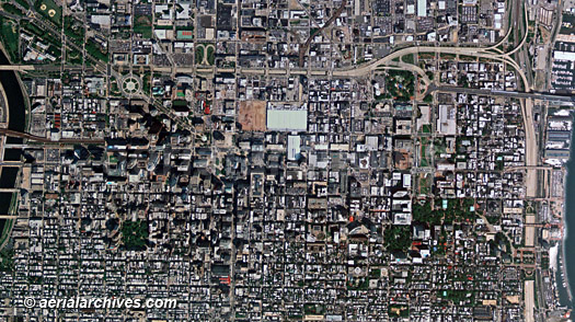
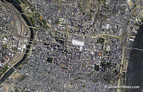
Aerial Archives also provides comprehensive vertical aerial photography coverage(aerial photo maps) of Philadelphia . To obtain an aerial photo map of Philadelphia or the greater Philadelphia metropolitan area customized to show your specific area of interest, please contact us.
|
|
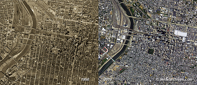
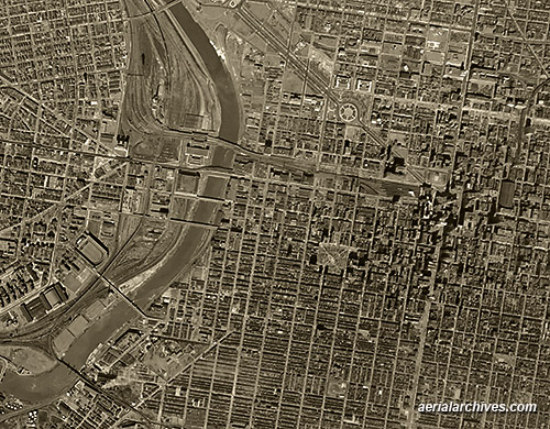
Aerial Archives also provides extensive historical aerial photography coverage of Philadelphia. The historical aerial photographs of the comparison between 1950 and 2010 in Philadelphia shown on this page are available for immediate online license or prints or, to obtain them optimized to your needs please contact Aerial Archives directly and reference the ID number in the caption to the photograph.
|
|
A more detailed view of Philadelphia in 1950. The historical aerial photograph shown above of Philadelphia in 1950 is available for immediate online license or prints or, to obtain it optimized to your needs please contact Aerial Archives directly and reference the ID number in the caption to the photograph. For historical aerial photography of Philadelphia not shown on this site, we recommend you use the pdf research request form.
|