

Aerial Photographs of Queens, New York
Aerial Photographs of Queens for Immediate Download
|
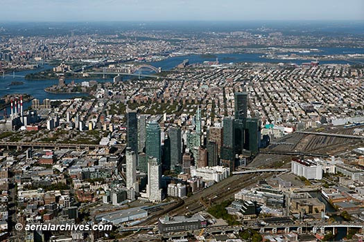
An extensive selection of current and historical aerial photographs of Queens, New York is represented in the aerial photography library of Aerial Archives. To view thumbnails of aerial photographs of Queens, New York available for immediate online license, please consult aerial photographs of Queens. This collection includes oblique aerial photographs of Queens, New York, including aerial views of the Queens waterfront, the LaGuardia airport, major venues, freeways, avenues, parks and buildings. The archive also contains a comprehensive collection of vertical Queens New York aerial photography including aerial photos of Queens, NY and the entire New York metropolitan area both in color and black and white and Queens, New York aerials in infrared color for an entirely different look. The aerial photograph of the skyscrapers in Long Island City, Queens, New York shown on this page is available for immediate online license or prints or, to obtain it optimized to your needs please contact Aerial Archives directly and reference the ID number in the caption to the photograph.
|
|
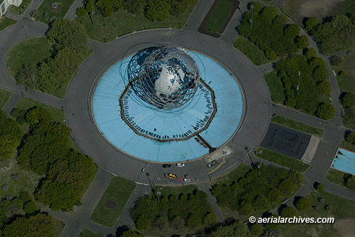
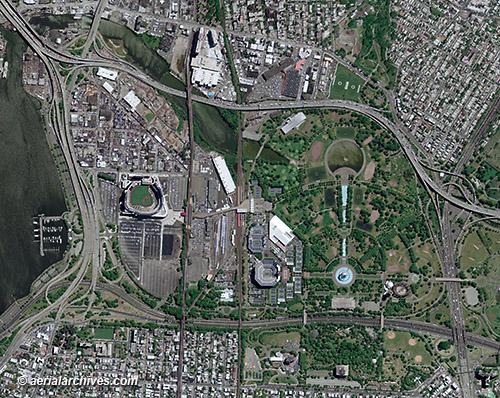
The aerial photograph of the Unisphere in Corona Park, Queens, New York shown on this page is available for immediate online license or prints or, to obtain it optimized to your needs please contact Aerial Archives directly and reference the ID number in the caption to the photograph.
|
|
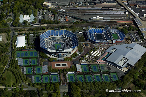
The Aerial Archives library also contains aerial photographs of the major sports venues in Queens, New York. The aerial photograph of the Arthur Ashe Stadium and Billie Jean King National Tennis Center in Queens, New York shown on this page is available for immediate online license or prints or, to obtain it optimized to your needs please contact Aerial Archives directly and reference the ID number in the caption to the photograph. . |
|
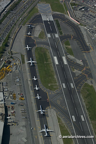
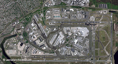
The Aerial Archives library also contains current and historical aerial photographs of the LaGuardia and John F. Kennedy International Airports in Queens, New York.
|
Aerial Photo Maps of JFK International Airport, Queens, New York
|
Also available are current and historical vertical aerial photographs (aerial photo maps) of Queens, New York and the rest of New York City. Additional information is available at aerial photo maps of New York City. To obtain the aerial photo maps of the John F. Kennedy International Airport and the sports facilities in Flushing, in Queens, New York shown above optimized to your needs please contact Aerial Archives directly and reference the ID numbers in the caption to the photographs. |
|
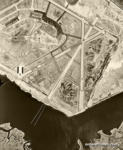
High resolution historical aerial photographs are available for all of Queens, New York. The historical aerial photograph of what is now John F. Kennedy Airport in Queens, New York shown on this page is available for immediate online license or prints or, to obtain it optimized to your needs please contact Aerial Archives directly and reference the ID number in the caption to the photograph. To obtain historical stock aerial photography of Queens, New York not shown on this site we recommend you use the pdf research request form. Additional information about obtaining stock aerial photography is also available at aerial photography research and at aerial photography research FAQs. |