

Aerial Photographs of Sacramento, CA
Sacramento Aerial Photographs For Immediate Download
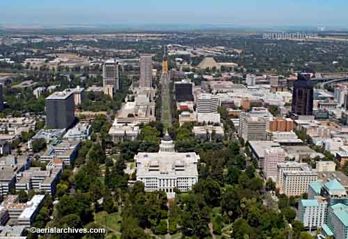
Aerial Archives creates custom aerial photography of Sacramento, California and its library contains an extensive selection of aerial photographs of Sacramento, California including vertical and oblique aerial photography of Sacramento, CA and other state capitals, including historical and current aerial photography. To view aerial photographs of Sacramento available for immediate online license or prints, please consult Sacramento aerials photographs. The collection of Sacramento aerial photography includes oblique aerial photographs of Sacramento county, including aerial photographs of downtown Sacramento, the Sacramento river and the Sacramento executive, Mather and Natomas airports. The Sacramento aerial photography collection includes aerial photographs of the California state government buildings, including the State Legislature and executive offices in the Capitol Mall area, and the larger buildings in the state's capitol. Also included in this collection of aerial photographs are the surrounding communities including Rocklin, Roseville, Lincoln, and Folsom. Available imagery also includes aerial maps of Sacramento, vertical (straight down) aerial photography and georeferenced aerial photography of the greater Sacramento area, delivered both as prints and digital files. To obtain an aerial photograph not shown here, please contact Aerial Archives. The aerial photograph of the California State Capitol building in Sacramento shown above is available for immediate online license or prints or, to obtain it optimized to your needs please contact Aerial Archives directly and reference the ID number in the caption to the photograph.
|
|
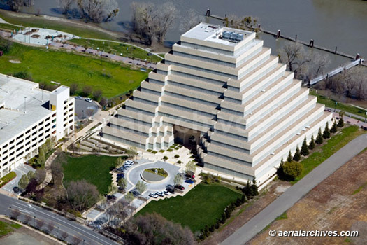
The aerial photograph of the Ziggurat Building, in Sacramento shown above is available for immediate online license or print or, to obtain it optimized to your needs please contact Aerial Archives directly and reference the ID number in the caption to the photograph.
|
|
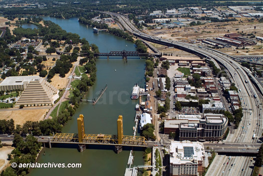
The aerial photograph of the Sacramento River and Old Town Sacramento with the Tower Bridge in the foreground shown above is available for immediate online license or prints or, to obtain it optimized to your needs please contact Aerial Archives directly and reference the ID number in the caption to the photograph.
|
|
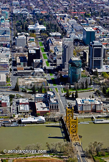
The aerial photograph of the Tower Bridge, Sacramento skyline at the capitol building shown above is available for immediate online license or prints or, to obtain it optimized to your needs please contact Aerial Archives directly and reference the ID number in the caption to the photograph.
|
|
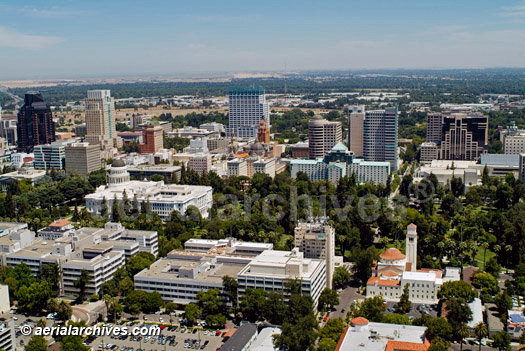
The collection includes numerous low altitude aerial photographs of the Sacramento skyline. The aerial photograph of the Sacramento skyline at the capitol building shown above is available for immediate online license or prints or, to obtain it optimized to your needs please contact Aerial Archives directly and reference the ID number in the caption to the photograph.
|
|
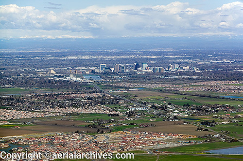
The aerial photograph of residential development in Sacramento shown above is available for immediate online license or prints or, to obtain it optimized to your needs please contact Aerial Archives directly and reference the ID number in the caption to the photograph.
|
|
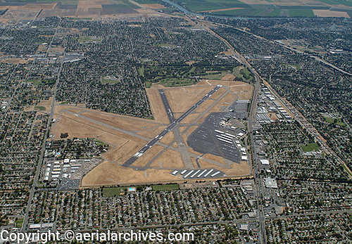
The aerial photograph of the Sacramento Executive Airport (SAC) shown above is available for immediate online license or prints or, to obtain it optimized to your needs please contact Aerial Archives directly and reference the ID number in the caption to the photograph. If you need a vertical (straight down) aerial photograph of the Sacramento Executive Airport, please contact Aerial Archives directly. For information about historical aerial photographs of Sacramento, please consult Aerial Maps of Sacramento. For custom aerial photography of Sacramento or to obtain an aerial photograph of Sacramento not shown here, please contact Aerial Archives. For historical aerial photography we recommend that you use the research request form. Additional information about obtaining existing aerial photography is also available at aerial photography research and at aerial photography research FAQs.
|