

Aerial Photographs of Salt Ponds for Immediate Download
|
The Aerial Archives library contains one of the largest collections of aerial photographs of salt ponds. Available are both oblique aerial views of the salt ponds and various features of the salt ponds, and aerial maps showing the entire salt pond system. For additional aerial photographs of salt ponds available for immediate download or prints, please visit aerial photographs of salt ponds.A particular strength of the archive is the large collection of aerial photographs of San Francisco Bay salt ponds, including aerial photographs of the Napa salt ponds and the south bay salt pond systems terminating in the crystallizer beds of Newark and Redwood City. Aerial photographs of salt ponds of the San Francisco Bay Area are particularly interesting at this time, because of the large wetland and habitat restoration projects planned in connection with the conversion of the salt ponds into tidal wetlands and other habitats. In addition to the collection of aerial photography of salt ponds of the San Francisco Bay Area of Herb Lingl, the collection also contains infrared aerial photography of salt ponds, aerial photography of salt ponds located in Mexico and historical aerial photography of the salt ponds of the San Francisco Bay Area. The aerial photograph of the Napa salt crystallizer ponds shown above is available for immediate online license or prints or, to obtain it optimized to your needs please contact Aerial Archives directly and reference the ID number in the caption to the photograph.
|
|
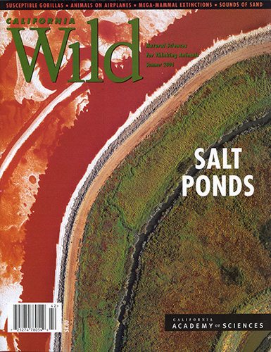
Aerial Archives' photographer, Herb Lingl was featured in the cover article about Salt Ponds the Summer, 2004 issue of California Wild, the magazine of the California Academy of Sciences. The article, entitled, Past the Salt: A Photographic Essay of San Francisco Bay by aerial photographer Herb Lingl features 14 of Herb Lingl's aerial photographs of salt ponds including a spread of the highly saline ponds of Newark, and a spread of crystallizer beds and high saline ponds of the Napa salt pond system. The aerial photograph used on the cover of California Wild magazine is available for immediate online license or prints or, to obtain it optimized to your needs please contact Aerial Archives directly and reference the ID number in the caption to the photograph. |
|
To obtain historical aerial photograph of salt ponds or the areas before the salt ponds were created, please use the
research request form. Additional information about obtaining existing aerial photography is also available at aerial photography research and at aerial photography research FAQs. |
|
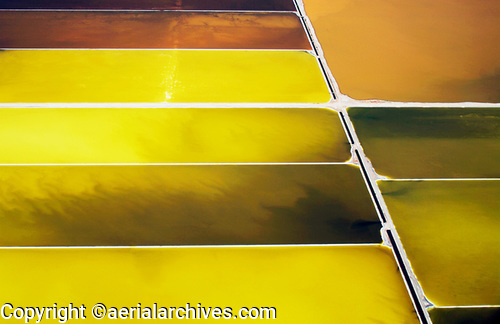
This aerial photograph of the San Francisco Bay salt pond crystallizers is available for immediate
license or prints or, to obtain it optimized to your needs please contact Aerial Archives
directly and reference the ID number in the caption to the photograph.
|
|
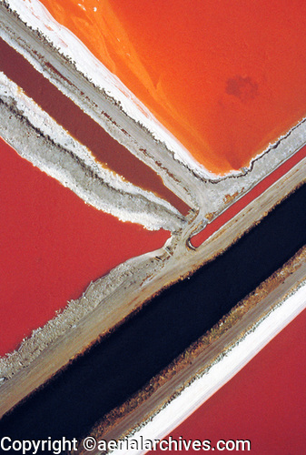
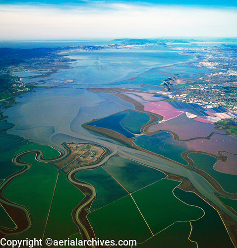
This aerial photograph of the San Francisco Bay Area salt pond network is available for immediate
license or prints or, to obtain it optimized to your needs please contact Aerial Archives
directly and reference the ID number in the caption to the photograph.
|
|
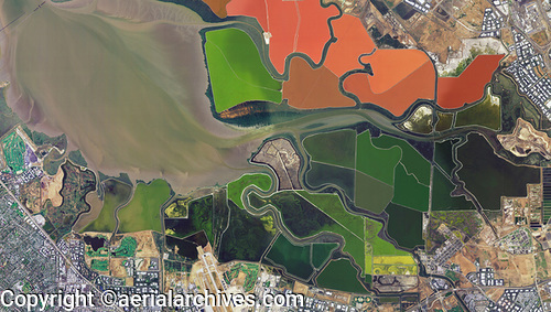
This aerial photo map of the San Francisco Bay Area salt pond network is available for immediate
license or prints or, to obtain it optimized to your needs please contact Aerial Archives
directly and reference the ID number in the caption to the photograph.
|