

Aerial Photographs of Santa Barbara, CA
Santa Barbara Aerial Photography For Immediate Download
|
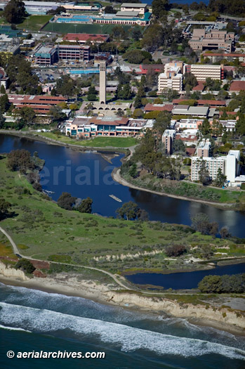
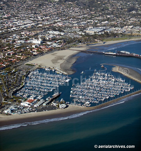
The aerial photography library of Aerial Archives contains an extensive selection of aerial photographs of Santa Barbara County, California. This aerial photography collection includes oblique aerial photographs of Santa Barbara, CA, including aerial views of downtown Santa Barbara, the Santa Barbara Municipal airport (SBA), the Santa Ynez Valley and the Santa Barbara wine country, and Santa Maria. Also available are numerous aerial photographs of the individual buildings in Santa Barbara and extensive aerial photography of the Santa Barbara harbor. The collection also includes aerial photographs of the University of California Santa Barbara UCSB and many of coastal homes in Santa Barbara. The aerial photograph of Santa Barbara, California shown above is available for immediate online license or prints or, to obtain it optimized to your needs please contact Aerial Archives directly and reference the ID number in the caption to the photograph.
The archive also contains a comprehensive collection of current and historical vertical aerial photographs and aerial maps of Santa Barbara and the surrounding area.
|
|
For custom aerial photography of or to order a specific aerial photograph of Santa Barbara, CA not shown on this site, please contact Aerial Archives directly. For historical research of aerial photography and satellite imagery of the City and County of Santa Barbara, California we recommend that you use the research request form. Additional information about the process of researching historical aerial photography for your location is available at aerial photography research. |