

Aerial Photographs Of Santa Rosa, California
Aerial Photographs of Santa Rosa for Immediate Download
|
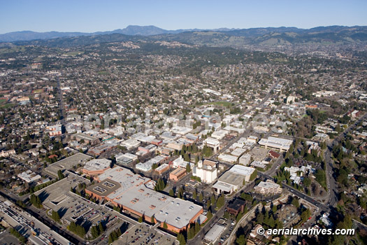
Aerial Archives creates custom aerial photography of Santa Rosa, California and its library contains an extensive selection of aerial photographs of Santa Rosa, California. The aerial photography collection includes oblique aerials of the entire city limits of Santa Rosa including views of each of the major roads, intersections and the downtown shopping area as well as the major golf courses and commercial real estate located in Santa Rosa. Also included in the archive are the regions immediately surrounding Santa Rosa including the Highway 12 area toward Sonoma, the Russian River and Highway 101 to the north. The archive also contains a comprehensive collection of vertical aerial photographs of Santa Rosa including both current and historical aerial photos of Santa Rosa both in color and black and white. For custom aerial photography of a location in Santa Rosa or Sonoma county or for specific requests for Santa Rosa aerial photography please contact Aerial Archives.
|
|
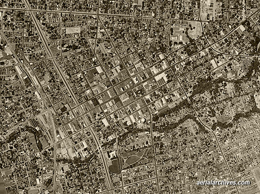
Aerial Archives delivers historical aerial photography of Santa Rosa and other portions of Sonoma county. For historical aerial photography of Santa Rosa we recommend that you use the research request form. Additional information about obtaining existing aerial photography is also available at aerial photography research and at aerial photography research FAQs. |