

|
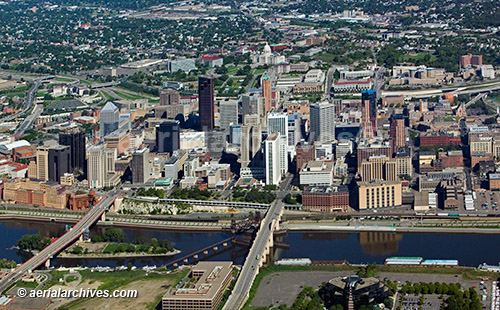
The aerial photography library of Aerial Archives contains a broad and diverse selection of aerial photographs of St. Paul, Minnesota in Ramsey county. This aerial photography collection includes oblique aerial photographs of St. Paul, Minnesota, including aerial views of downtown St. Paul, the corporate headquarters of the Minnesota Mining and Manufacturing company, 3M, the Minneapolis St Paul international World Chamberlain airport (MSP), St Paul Holman Field, and the surrounding communities including Lake Minnetonka and major geographic features and freeways including the golf courses, parks, hospitals and major downtown streets. Also available are numerous aerials of the individual buildings in downtown St. Paul including the state capitol. The aerial photograph of downtown St. Paul, MN shown above is available for immediate online license or prints or, to obtain it optimized to your needs please contact Aerial Archives directly and reference the ID number in the caption to the photograph.
|
|
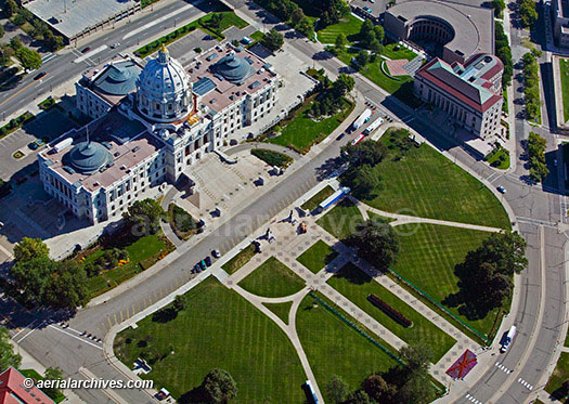
The aerial photograph of Minnesota
State Capitol building in St. Paul shown above is available for immediate online license or prints or, to obtain it optimized to your needs please contact Aerial Archives
directly and reference the ID number in the caption to the photograph.
|
|
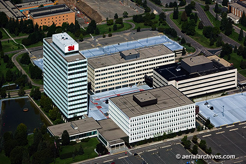
The aerial photograph of
the 3M Company headquarters in St. Paul, Minnesota shown above is available for immediate online license or prints or, to obtain it optimized to your needs please contact Aerial Archives
directly and reference the ID number in the caption to the photograph.
|
|
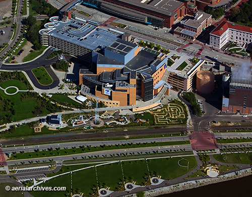
The aerial photograph of
the Minnesota Science Museum in St. Paul, Minnesota shown above is available for immediate online license or, to obtain it optimized to your needs please contact Aerial Archives
directly and reference the ID number in the caption to the photograph.
|
|
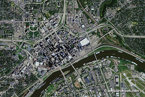
Aerial Archives provides comprehensive current and historical vertical coverage (aerial photo maps) of St. Paul. For additional details please visit To obtain the aerial photo map of downtown St. Paul, Minnesota shown on this page please contact Aerial Archives directly and reference the ID number in the caption to the photograph.
|
|
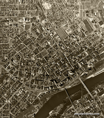
Aerial Archives provides comprehensive historical aerial photography coverage of Minneapolis and other parts of Minnesota. To obtain the historical aerial photograph of downtown St. Paul, Minnesota shown on this page please contact Aerial Archives directly and reference the ID number in the caption to the photograph.
For historical research of aerial photography of Minnesota we recommend that you use the research request form. Additional information about the process of researching historical aerial photography for your location is available at aerial photography research and at aerial photography research FAQs. |