

Aerial Photographs of Orlando, Florida for Immediate Download
|
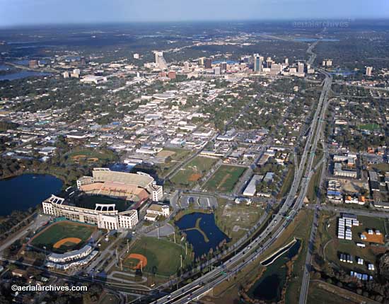
A broad selection of aerial photographs of Orlando, Florida is represented in the library of Aerial Archives. This collection includes oblique aerial photographs of Orlando, FL, including aerial views of downtown Orlando, the Citrus stadium, Universal Studios, the theme parks of Disney World, including EPCOT Center, the Magic Kingdom, Disney's private airstrip, the Disney tram system and more. Major hotels and golf courses are also represented in the archive as are numerous aerials of the Orlando Convention Center and Seaworld. The archive also contains a comprehensive collection of vertical Orlando aerials including aerial photos of Orlando and the entire Orlando metropolitan area both in color and black and white. In additional to aerial photography of Orlando, FL, the archive also contains other aerial photographs of central Florida including Daytona, FL the Kennedy Space Center and the wetlands in the vicinity of the Kennedy Space Center. The aerial photograph of Camping World Stadium, Orlando, Florida shown above is available for immediate online license or prints or, to obtain it optimized to your needs please contact Aerial Archives directly and reference the ID number in the caption to the photograph.
|

|
The aerial photograph of the Magic Kingdom, Walt Disney World in shown above is available for immediate online license or prints or, to obtain it optimized to your needs please contact Aerial Archives directly and reference the ID number in the caption to the photograph.
|

|
Aerial maps and satellite imagery of Orlando and other portions of the State of Florida are available for numerous dates. The aerial photograph of Orlando International Airport shown above is available for immediate online license or prints or, to obtain it optimized to your needs please contact Aerial Archives directly and reference the ID number in the caption to the photograph.
|
|
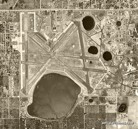
Aerial Archives provides historical aerial photography of Orlando and other parts of Florida. For historical aerial photography we recommend that you use the research request form. Additional information about obtaining existing aerial photography is also available at aerial photography research and at aerial photography research FAQs. For specific requests for Orlando aerial photography not shown on this site, please contact Aerial Archives directly. The historical aerial photograph of Orlando Executive Airport shown above is available for immediate online license or prints or, to obtain it optimized to your needs please contact Aerial Archives directly and reference the ID number in the caption to the photograph.
|