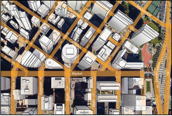
Aerial Map Graphics Services
Aerial Archives' graphic artist Naomi Hirooka creates unique aerial map graphics from aerial photography. These graphic works are available both from existing stock aerial photography and created from custom assignments. Existing and custom aerial map graphics based on aerial photography are available as prints and for licensing in digital form. Specialized services include delivery of geotiffs, customized labelling of aerial map graphics and output to specialized media. Aerial Archives aerial map graphics can also be completely customized both with respect to scale and to show an aerial view of the entire city.
To request a specific aerial map graphic please contact us.
|
|
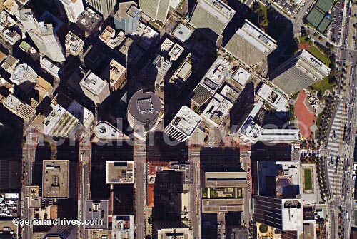
The aerial photograph of San Francisco, CA shown above is available for immediate online license, or
to obtain this image optimized to your specific specifications please contact Aerial Archives directly.
|