

Aerial Photography of Farming and Agriculture
Aerials Photographs of Agriculture for Immediate Download.
|
Aerial Archives provides aerial photography, aerial maps and satellite photogrpahy of agriculture and farming each of the important agricultural regions of the world. To view aerial photographs of farming and agriculture available for immediate online license or prints, please consult aerials photographs of agriculture. The collection includes high resolution infrared aerial photography of agricultural areas as well as seamless high resolution aerial maps of large agricultural regions. Included in the collection are aerial photographs of agricultural patterns, the irrigation aqueducts, barns, cattle ranches, clear cutting, crops, dairy, farms, farmlands, farming patterns, field preparation, fields, forrests, harvesting, irrigation patterns, livestock, orchards, planting, ranches, rice fields, tractors, agricultural lands in the spring, summer, fall and winter seasons, vineyards and wineries. Regions with particularly in depth coverage in the collection are aerial photographs of the California Wine Growing Regions the California Central Valley Texas rice growing fields and Rio Grande agriculture in Texas and New Mexico. Large areas of farmland and other agricultural areas are also included in the collection, including seamless continguous vertical (straight down) aerial photography of farming regions such as a central valley in California and the Napa and Sonoma valleys in California, the Mississippi delta and many other portions of the United States. A sample is available for review at aerial maps of Napa. Similar seamless aerial photographs are available for all important farming amd agricultural areas. The collection also includes infrared aerial photography of various agricultural subjects, including the Sacramento river delta. The aerial photograph of the farming and agriculture in California shown above is available for immediate online license or prints, or to obtain this image optimized to your specific specifications please contact Aerial Archives directly.
|
|
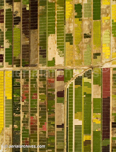
The aerial photograph of the northern California flower farm shown above is available for immediate online license or prints, or to obtain this image optimized to your specific specifications please contact Aerial Archives directly.
|
|
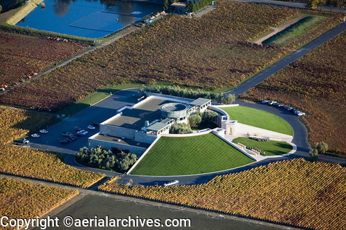
The aerial photograph of the farming in Napa county is one of a large collection of aerial photographs of wineries and vineyards. Additional vineyard images are available at aerial photography of vineyards.
The aerial photograph of the Opus One winery in Oakville, CA in the Napa Valley shown above is available for immediate online license or prints, or
to obtain this image optimized to your specific specifications please contact Aerial Archives directly.
|
|
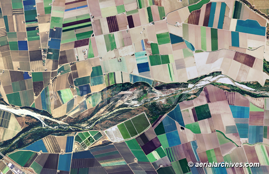
Aerial Archives also provides vertical aerial map and satellite photography coverage of each of the major agricultural regions around the world, including high resolution imagery of most areas. To view additional aerial photo maps of farming and agriculture available for immediate online license or prints, please consult aerials maps of agriculture. The aerial map of farming and agriculture aound the Salinas river in Monterey county shown on this page is available for immediate online license or prints.
|
|
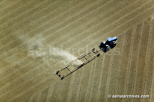
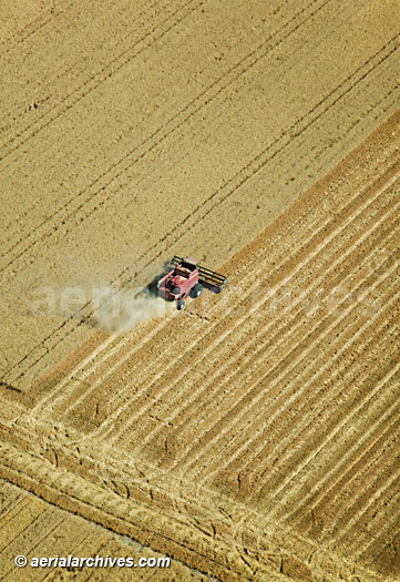
The aerial photograph of harvesting hay in California's central valley shown above is available for immediate online license or prints, or to obtain this image optimized to your specific specifications please contact Aerial Archives directly. For imagery not on this site, please contact Aerial Archives directly for assistance with your agricultural aerial photography image needs. For specific requests for historical aerial photographs of agricultural subjects and areas, please use the research request form. Additional information about obtaining existing aerial photography of agricultural areas is also available at aerial photography research and at aerial photography research FAQs.
|