

Anchorage & Kenai Peninsula, Alaska
Aerial Photography
Aerials Photographs and Maps of Anchorage and Vicinity Available for Immediate License
|
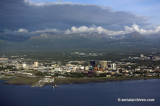
Aerial Archives has created an extensive selection of aerial photography of Anchorage, Alaska and vicinity and also provides aerial maps for numerous locations in Alaska. To view thumbnails of aerial photographs of Alaska available for immediate online license, please consult aerials photographs of Alaska. Aerial photography includes of the city of Anchorage, the Anchorage International Airport, Merrill Field, the Cook Inlet, the Chugach Mountains, the Kenai Peninsula including the Kenai National Wildlife Refuge and the Chugach National Forest, Turnagain Arm, Chickaloon Bay, the Sustina Flats State Game Refuge, the Chigmit Mountains, the Lake Clark National Park and Lake Clark Wilderness, the Neacola Mountains, Girdwood, the Portage Valley, the Placer River Valley, Hope, Alaska, and the surrounding areas. Aerial Archives can also provide to clients imagery from an extensive archive of current and historical aerial photographs and satellite imagery of Alaska. Aerial Archives also delivers imagery from an extensive collection of historical satellite and aerial photography of Anchorage, Alaska and vicinity. This includes declassified military satellite imagery, Landsat imagery, and aerial photography acquired in 1953, 1955, after the 1964 earthquake, and current aerial and satellite imagery. For additional information please consult Aerial and Satellite Maps of Alaska. For historical research of aerial photography and satellite imagery of Anchorage, Valdez and other portions of Alaska, we recommend that you use the research request form. Additional information about the process of researching historical aerial photography or satellite imagery for your location is available at aerial and satellite imagery research. The aerial photograph of Anchorage, Alaska from the Cook Inlet shown above is available for immediate online license or prints. Aerial Archives will also deliver this image optimized to your specific specifications either as a digital file on CD, DVD or via the internet, or as a print, aerial mural, transparency or backlit display. To obtain customized service, please contact Aerial Archives directly.
|
|
The aerial photograph of Anchorage, Alaska taken from the final approach into Merrill Field Airport (MRI) at dusk in the evening is available for immediate online license or prints, or, to obtain it optimized to your specifications, please contact Aerial Archives directly.
|
|
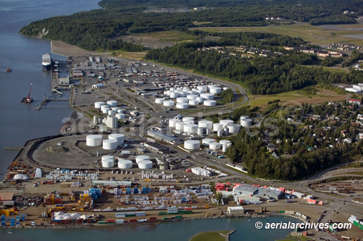
The collection of aerial photography of Anchorage, Alaska contains numerous oblique aerial photographs of the aiport facilities at the Port of Anchorage. The aerial photograph shown aboveof the oil storage facilities at the Port of Anchorage in Anchorage, Alaska is available for immediate online license or prints, or, to obtain it optimized to your specifications, please contact Aerial Archives directly.
|
|
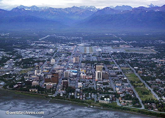
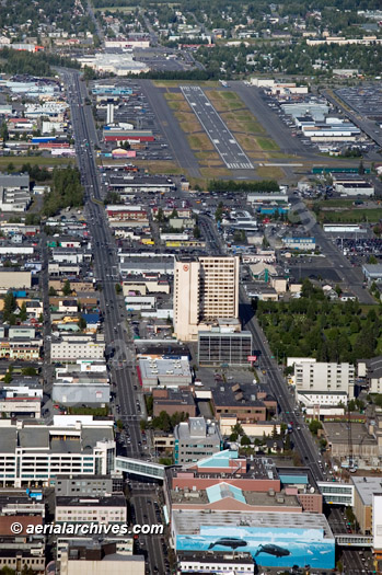
The collection of aerial photography of Anchorage, Alaska contains numerous oblique aerial photographs of the aiport facilities at Anchorage including Anchorage international airport and Merrill Field. The aerial photograph shown above of downtown Anchorage, Alaska and Merrill Field (MRI) is available for immediate online license or prints, or, to obtain it optimized to your specifications, please contact Aerial Archives directly.
|
|
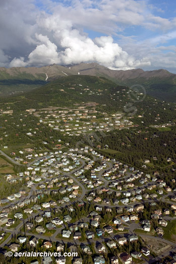
Aerial Archives collection of aerial photography of Anchorage, Alaska also documents the development occuring in the residential areas around Anchorage. The aerial photograph shown above of a residential community south of Anchorage, Alaska is available for immediate online license or prints, or, to obtain it optimized to your specifications, please contact Aerial Archives directly.
|
|
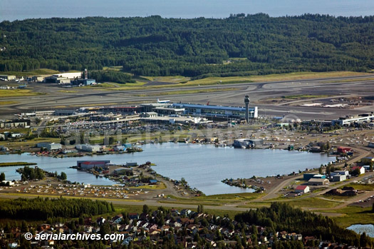
The aerial photograph shown above of Ted Stevens Anchorage International Airport (ANC) and the Lake Hood Seaplane base is available for immediate online license or prints, or, to obtain it optimized to your specifications, please contact Aerial Archives directly.
Information about vertical aerial photography (aerial maps) of Alaska including aerial maps of the Anchorage airport, please consult
If we are unable to find existing aerial or satellite imagery for your project, consider taking advantage of our unique capabilities to provide you with customized satellite or aerial photography for your Alaska project. To discuss how we might approach your custom aerial photography project, either aerial photography from a helicopter or airplane or tasking a satellite to acquire imagery for you, please contact us. For historical aerial photography of Anchorage, Alaska we recommend that you use the research request form.Additional information about obtaining existing aerial photography of Anchorage is also available at aerial photography research and at aerial photography research FAQs.
|