

|
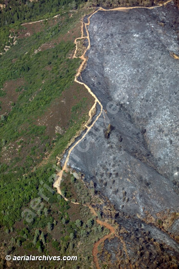
Aerial Archives provides aerial photographs, aerial maps and satellite imagery of wildfires and burn areas. Included in the collection are both vertical aerial photographs and oblique aerial photographs of wildfires in California, with particular in depth coverage of wildfire incidents in the San Francisco Bay area, Sonoma County, Napa County, Solano County and in the greater Los Angeles area and southern California. A selection of images from this collection is available for online licensing and print orders at: California Wildfires Aerial Photography and Satellite Imagery.
|
Aerial Photographs of Wildfires and their Aftermath
|
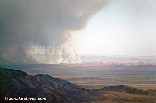
The aerial photograph of Geysers fire in Sonoma County California shown above is available for immediate online license, or to obtain this image optimized to your specification, please contact Aerial Archives directly.
|
|
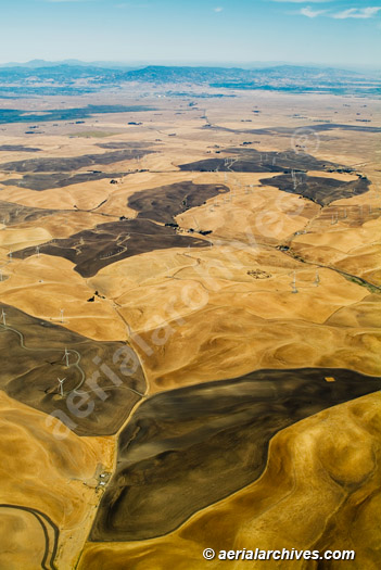
The Aerial Archives library contains numerous aerial photographs of controlled burns and controlled burn areas in California and other portions of the western USA. The aerial photograph of controlled burn areas at wind turbines Contra Costa County, CA shown above is available for immediate online license or prints. Aerial Archives will also deliver this image optimized to your specific specifications either as a digital file on CD, DVD or via the internet, or as a print, aerial mural, transparency or backlit display. To obtain customized service, please contact Aerial Archives directly.
|
|
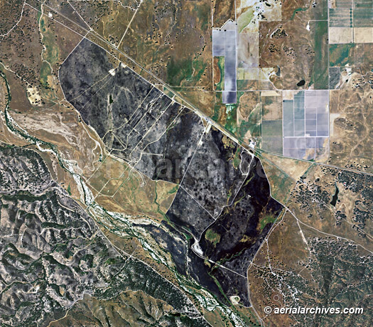
Aerial Archives provides aerial maps, vertical aerial photography and satellite imagery of fire burn areas before and after the fire and creates such aerial photography of assignment. The aerial map of the fire in Monterey County, CA shown above is available for immediate online license or prints. Aerial Archives will also deliver this image optimized to your specific specifications either as a digital file on CD, DVD or via the internet, or as a print, aerial mural, transparency or backlit display. To obtain customized service, please contact Aerial Archives directly.
To obtain a specific stock aerial photograph of fires and burn areas not shown on this site, please contact Aerial Archives directly. Additional information about obtaining historical aerial photography of fire and burn areas both before and after the fire is also available at aerial photography research and at aerial photography research FAQs. |