

Aerial Photo Maps and Satellite Imagery of Riverside County, CA
Aerial Photographs of Riverside County For Immediate Download
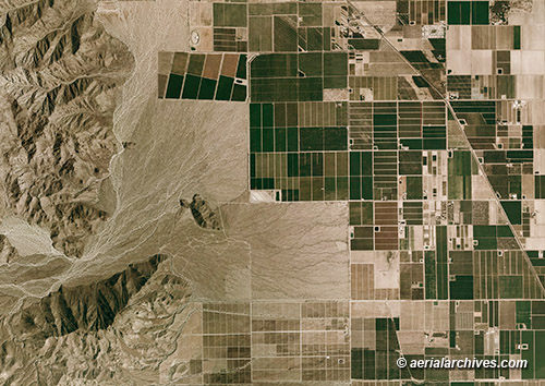
An extensive selection of vertical aerial photography and high resolution satellite imagery of Riverside County, CA, is available from Aerial Archives, including aerial photo maps of Riverside County, CA and historical and current aerial photography. Available imagery includes georeferenced aerial photography and satellite imagery of all of Riverside County or any customized portion, including aerial photographs of Banning, Beaumont, Blythe, Calimesa, Canyon Riverside, Cathedral, Coachella, Corona, Desert Hot Springs, Hemet, Indian Wells, Indio, Elsinore, La Quinta, Moreno Valley, Murrieta, Norco, Palm Desert, Palm Springs, Perris, Rancho Mirage, Riverside, San Jacinto and Temecula. Imagery can be delivered both as prints and in digital form. Specialized services include delivery of geotiffs, customized labelling of aerial photo maps and output to specialized media. The aerial photography and satellite coverage of aerial photo maps of Riverside County, CA can also be completely customized both with respect to scale. For current aerial photography coverage of Riverside County, California please contact us. The aerial photograph of desert farming in Riverside County, California is available for immediate online license or prints, or to obtain this image optimized to your specific specifications please contact Aerial Archives directly.
|
Aerial Photo Map Desert Shores, Salton Sea
Aerial Photographs of the Salton Sea For Immediate Download
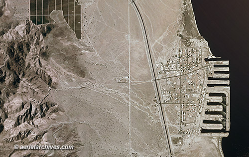
Aerial photo maps of the entire area around the Salton Sea are available from Aerial Archives. The aerial photograph of Desert Shores in Riverside County, California is available for immediate online license or prints, or to obtain this image optimized to your specific specifications please contact Aerial Archives directly.
|
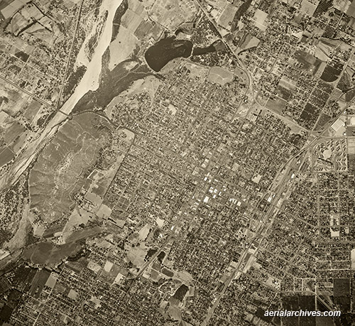
Aerial Archives provides historical aerial photography and satellite imagery of Riverside County. For historical research of aerial photography and satellite imagery, we recommend that you use the research request form. Additional information about the process of researching historical aerial photography for your location is available at aerial photography research. The historical aerial photograph of Riverside, California is available for immediate online license or prints, or to obtain this image optimized to your specific specifications please contact Aerial Archives directly.
|