

Aerial Photographs of Forest Clear Cutting
Aerials Photographs of Clear Cutting Available for Immediate License
|
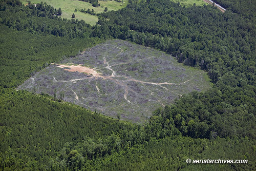
Aerial Archives provides aerial photographs, aerial maps and satellite imagery of forest clear cutting. To view aerial photographs of clear cutting available for immediate online license, please consult aerials photographs of clear cutting. Included in the collection are both vertical aerial photographs and satellite imagery and oblique aerial photographs of forest clear cutting in the Unitd States and Central America. The aerial photograph of the forest clear cuttting in Alabama shown on above is available for immediate online license or prints or, to obtain it optimized to your needs please contact Aerial Archives directly and reference the ID number in the caption to the photograph.
|
|
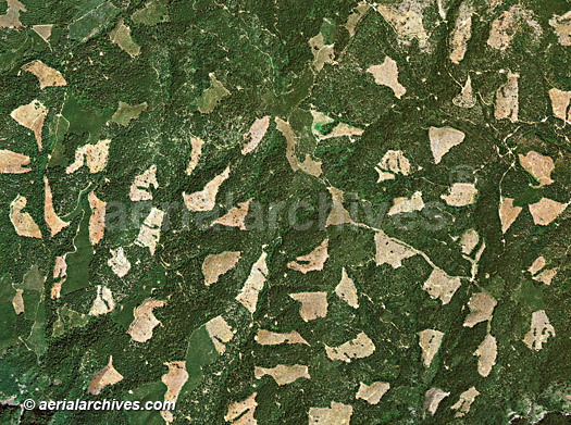
Aerial Archives also provides high resolution vertical aerial photography, aerial maps, and high resolution satellite imagery of forest clear cutting.
The aerial map of the forest clear cuttting in El Dorado county California shown above is available for immediate online license or prints or, to obtain it optimized to your needs please contact Aerial Archives directly and reference the ID number in the caption to the photograph. . |
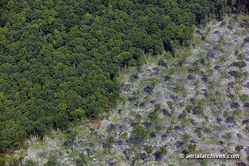
Aerial Photographs of Aggressive Forest Thinning
|
The aerial photograph of the aggressive forest thinning in Pennsylvania shown above is available for immediate online license or prints or, to obtain it optimized to your needs please contact Aerial Archives directly and reference the ID number in the caption to the photograph.
|
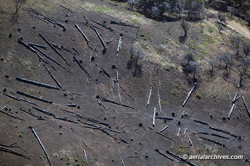
Aerial Photographs of Clear Cutting Invasive Species
|
The aerial photograph of clear cutting eucalyptus trees on Angel Island shown on this page is available for immediate online license or prints or, to obtain it optimized to your needs please contact Aerial Archives directly and reference the ID number in the caption to the photograph.
|