

Aerial Photography of Everglades National Park
Aerial Photographs of Everglades National Park For Immediate Download
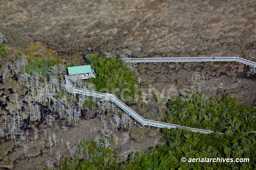
Aerial Photograph of Viewing Platform
Everglades National Park, Florida
Image ID: AHLB6044
© Herb Lingl/aerialarchives.com
Terms of Image Use |
Immediate License or Prints
Feedback
Aerial Archives creates custom aerial photographs of Everglades and its library of aerial images contains a large collection of aerial photographs of Everglades, including both high overviews of Everglades , and detailed aerial photographs. The archive includes over 1000 low altitude aerial photographs of Everglades, including detailed views of the sediment flows in the valley, sand dunes, artist's rock, and numerous other geological features.
The aerial photograph of a viewing platform in the Everglades National Park shown above is available for immediate online license or prints, or
to obtain this image optimized to your specific specifications please contact Aerial Archives directly.
Aerial Photograph of Shark Point Look Out Tower
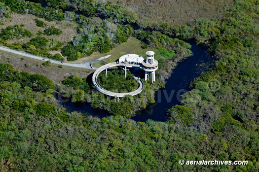
Shark Point Look Out Tower
Everglades National Park, Florida
Image ID: AHLB6046
© Herb Lingl/aerialarchives.com
Terms of Image Use |
Immediate License or Prints
Feedback
Aerial Maps of the Everglades National Park, Florida
The aerial photograph of the Shark Point Look Out Tower Everglades National Park shown above is available for immediate online license or prints, or
to obtain this image optimized to your specific specifications please contact Aerial Archives directly.
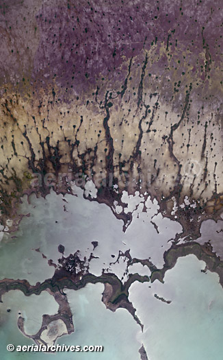
Aerial Map of Everglades National Park, Florida
Image ID: AHLV2075
© aerialarchives.com
Terms of Image Use |
Immediate License or Prints
Feedback
The library also contains comprehensive vertical coverage of Everglades and specific categories including environmental subjects, geographic features, nearby airports and park facilities and numerous additional categories.
For custom aerial photography of Everglades or for specific requests for Everglades National Park, Florida aerial photography not shown on this site or to obtain aerial photographs optimized to your specific specification please contact Aerial Archives or consult Aerial Archives research.
The aerial map of the Everglades National Park shown above is available for immediate online license or prints, or
to obtain this image optimized to your specific specifications please contact Aerial Archives directly.