

Aerial Photographs of Sonoma County, California
Aerial Photographs of Sonoma County for Immediate Download
An extensive and in depth selection of aerial photographs of Sonoma county in California is represented in the library of Aerial Archives.
To view aerial photographs of Sonoma county available for immediate online license or prints, please consult aerial photographs of Sonoma county.
The collection includes oblique aerial photographs of all of Sonoma county including aerial views of each of the individual cities and townships of Sonoma county.
Bodega Bay, The archive also contains a comprehensive collection of current and historical vertical Sonoma county aerials including aerial photos of Sonoma county both in color and black and white. For additional details please consult aerial maps of Sonoma county.
The aerial photograph of mouth of the Russian River and Jenner, Sonoma County, California shown above is available for immediate online license or prints, or to obtain this image optimized to your specifications, please contact Aerial Archives directly.
The aerial photograph of fog rolling in from the Pacific over Sonoma County toward the vineyards creating the unique grape growing environment in Sonoma County shown above is available for immediate online license or prints, or to obtain this image optimized to your specification, please contact Aerial Archives directly.
To order a specific stock aerial photograph of Sonoma county not shown on this site,please contact Aerial Archives.
Additional information about obtaining stock aerial photography is also available at
aerial photography research
and at
aerial photography research FAQs.
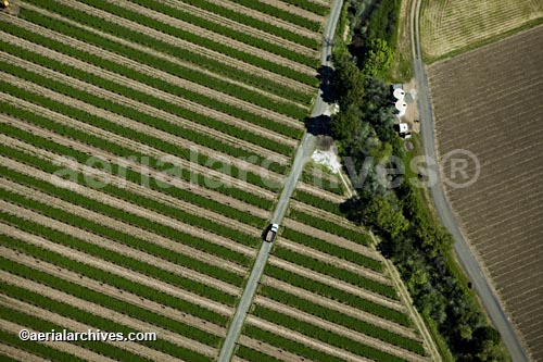
aerial photograph of rows of cover crops
in a Sonoma County vineyard
California
Image ID: AHLB2165
© Herb Lingl/aerialarchives.com
Terms of Image Use |
Immediate License or Prints
Feedback
Aerial photography of the Pacific Coastline, Sonoma County
Glen Ellen,
Guerneville,
Healdsburg,
Highway One,
the Infinion raceway,
Jenner,
Petaluma,
the Petaluma River,
Rohnert Park,
the Russian River,
Santa Rosa,
Sebastapol,
Shellville,
Sonoma,
the Sonoma baylands and
the wineries in Sonoma county.
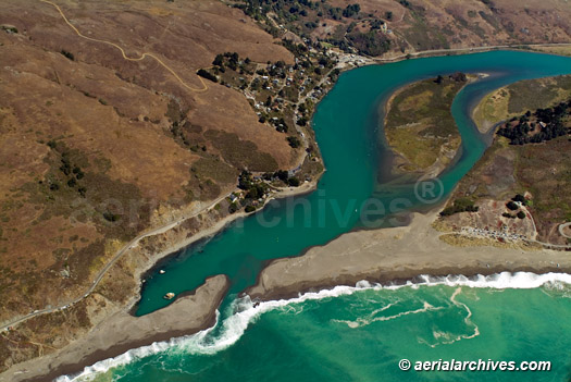
Jenner, Sonoma County, CA
Image ID: AHLB3970
© Herb Lingl/aerialarchives.com
Terms of Image Use |
Immediate License or Prints
Feedback
Aerial photography of Coastal Sonoma County
The Sonoma County Pacific coast is covered in detail in the aerial photography library of Aerial Archives.
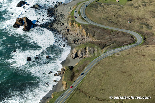
Sonoma County, California
Image ID: AHLB3302
© Herb Lingl/aerialarchives.com
Terms of Image Use |
Immediate License or Prints
Feedback
Aerial Photography of Sonoma County Vineyards and Wine Country
The aerial photograph of highway One on the Pacific Coast, Sonoma County, California shown above is available for immediate online license or prints, or to obtain this image optimized to your specification, please contact Aerial Archives directly.
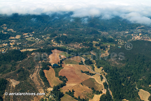
towards the Sonoma County vineyards
Image ID: AHLB3690
© Herb Lingl/aerialarchives.com
Terms of Image Use |
Immediate License or Prints
Feedback
The wineries and vineyards of Sonoma County are covered in detail in the aerial photography library of Aerial Archives.