

Aerial Maps and Satellite Imagery of Sonoma County
Aerial Photographs of Sonoma County for Immediate Download
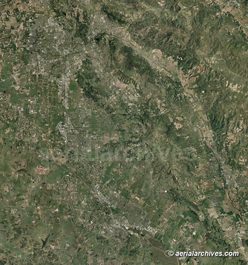
An extensive selection of vertical aerial photography and satellite imagery of Sonoma County, California is available from Aerial Archives including aerial maps of Sonoma County, and historical and current aerial photography. Available imagery includes georeferenced aerial photography and satellite imagery of Sonoma County, California delivered both as prints and as digital files. Available aerial photography and satellite imagery includes views of the entire county and of individual cities and townships including aerial maps of Agua Caliente, Asti, Bloomfield, Bodega, Bodega Bay, Bodega Harbour, Boyes Hot Springs, Bridgehaven, Buena Vista, Cadwell, Camp Meeker, Carmet, Carneros, Cazadero, Cotati, Cozzens Corners, Cunningham, Diamond A Ranch, Duncans Mills, El Verano, Eldridge, Fetters Hot Springs, Agua Caliente, Forestville, Freestone, Fulton, The Geysers, Geyserville, Glen Ellen, Graton, Gualala, Guerneville, Guernewood Park, Hacienda, Hessel, Jenner, Jimtown, Kellogg, Kenwood, Lakeville, Larkfield-Wikiup, Lytton, Mark West, Mark West Springs, Mercuryville, Mesa Grande, Mirabel Park, Mission Highlands, Monte Rio, Occidental, Penngrove, Petaluma, Rhonert Park, Rio Dell, Rio Nido, Rolands, Roseland, Salmon Creek, Santa Rosa, Schellville, Sea Ranch, Sebastapol, Serena del Mar, Soda Springs, Temelec, Two Rock, Valley Ford, Venada and Vineburg. The aerial map of Sonoma county shown above or any other portion of Sonoma County is available optimized to your specifications.
|
|
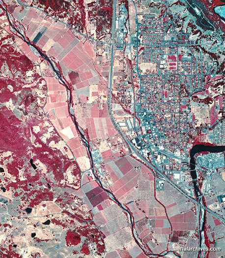
Aerial Archives provides infrared aerial map coverage of the the entire Sonoma county wine region.
For additional information about infrared aerial photography and satellite imagery and the information that can be obtained from these photographs, please consult infrared aerial photography. The infrared aerial map of the Healdsburg, California, Sonoma county shown above is available for immediate online license or prints, or to obtain this image optimized to your specification, please contact Aerial Archives directly.
|
|
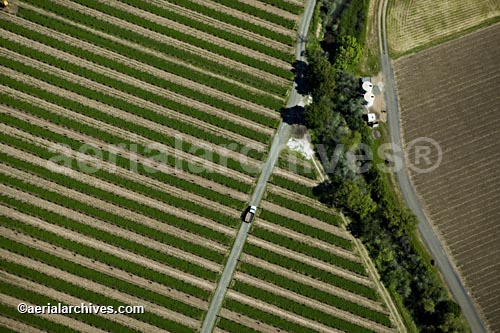
The library also contains detailed high resolution aerial maps of individual vineyards in Sonoma county. Also included is an extensive collection of oblique (at an angle) aerial photographs of Sonoma county. For additional information about the oblique aerial photography collection please consult aerial photographs of Sonoma county.
|
|
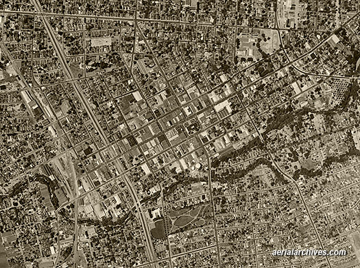
Aerial Archives also provides historical aerial photography of Sonoma County.
For current aerial maps and satellite imagery of Sonoma County, please contact us directly. For historical research of aerial photography of Sonoma County, California we recommend that you use the research request form. Additional information about the process of researching historical aerial photography for your location is available at aerial photography research.
|