

Infrared Aerial Photographs for Immediate Download
Infrared aerial photography is a powerful tool. Not only can it be used to document changes to the environment, the health of forests, wetlands, bays and oceans, but it can also be used to document and monitor such items as damage to roofs, the tracking of dairy farm out flows, pinpointing the source of, and monitoring, insect or disease infested vineyards, or sites contaminated by toxic chemicals, and many more applications. Infrared film and infrared digital sensors are sensitive to a certain portion of the spectrum of light, and by careful filtration, processing and selection of films, infrared aerials can provide invaluable information. Additional information about color infrared aerial photography is available at interpreting the meaning of color infrared aerial photography. Most infrared aerial documentation involves the creation of vertical infrared aerials. Combined with orthorecitification techiques, comprehensive infrared aerial maps can be created which can be invaluable both for planning and monitoring purposes. Infrared thermography is an effective tool for monitoring and examining the integrity of rooftops, steam facilities, landfills, coal mines and other features that have unique heat signatures. This imagery is acquired at night using cameras sensitive only to the infrared portion of the spectrum. Roof thermography projects are performed with a daylight mission for baseline photography together with a night infrared imaging mission shortly after nightfall at a time when temperature differences are the most pronounced and therefore most visible.
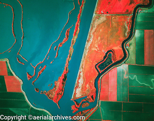
This infrared aerial photograph of Sacramento river deep water ship channel shown above is available for immediate online license or prints or, to obtain it optimized to your needs please contact Aerial Archives directly and reference the ID number in the caption to the photograph. Aerial Archives also maintains an extensive archive of infrared aerial photographs covering most of the United States. The company can also provide existing thermography for certain limited urban markets. Thermography of the city of San Francisco is available with a 1' pixel resolution. In addition the Aerial Archives library contains oblique photographs created on infrared film. To discuss options for your specific infrared aerial photography project, please contact us. |