

Historical Aerial Photographs of the 1940s
Historical Aerial Photographs from the 1940s For Immediate Download
|
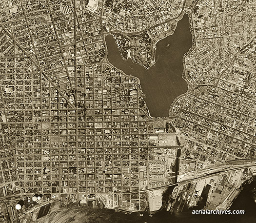
An extensive number of high resolution historical aerial photography from the 1940s is available from Aerial Archives for numerous locations around the United States. A selection of those 1940s historical aerial photos is available for immediate download or pints at historical aerial photos of the 1940s. To obtain the historical aerial photograph of downtown Oakland, California shown above please visit immediate license or prints.
Additional information about historical aerial photographs of Oakland is available at
historical aerial photographs of Oakland.
|
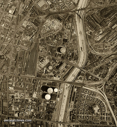
Historical Aerial Photographs of Los Angeles, California
|
Numerous additional historical aerial photographs of Los Angeles are available for immediate license or prints at historical aerial photographs of Los Angeles. To obtain the historical aerial photograph of Los Angeles, California infrastructure shown above please visit immediate license or prints. Aerial Archives provides research services for historical aerial photographs and can usually locate an useful historical aerial photograph for clients. For historical research of aerial photography, we recommend that you use the pdf research request form. Additional information about the process of researching historical aerial photography for your location is available at aerial photography research.
|