

Aerial Maps and Satellite Imagery of Orange County, California
Orange County California Aerial Photographs For Immediate Download
|
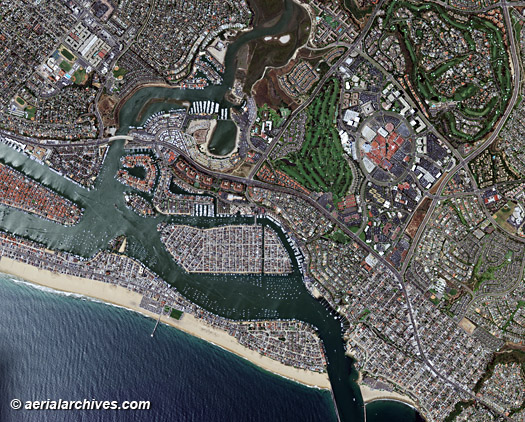
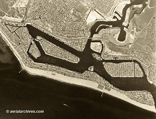
Comprehensive current and historical aerial maps and satellite imagery of Orange county, California are available from Aerial Archives. Available imagery includes high resolution digital files, large murals, prints and other products. The coverage of aerial photo maps and satellite imagery of Orange county, California can also be completely customized both with respect to scale and to show the entire city or metropolitan area or only a set of blocks. Aliso Viejo, Anaheim, Balboa Island, Brea, Buena Park, Corona Del Mar, Costa Mesa, Cypress, Dana Point, Foothill Ranch, Fountain Valley, Fullerton, Garden Grove, Huntington Beach, Irvine, Laguna Beach, La Habra, Lake Forest, La Palma, Los Alamitos, Mission Viejo, Newport Beach, Newport Coast, Orange, Orange Park Acres, Placentia, Rancho Santa Margarita, San Clemente, San Juan Capistrano, Santa Ana, Santa Ana Heights, Seal Beach, Stanton, Turtle Rock, Tustin, Tustin Ranch, Villa Park, Westminster, Yorba Linda are all covered. The entire county is also available digitally or as prints. The aerial photo map of Newport Beach, Orange County, California shown above is available for immediate online license or prints or, to obtain it optimized to your needs please contact Aerial Archives directly and reference the ID number in the caption to the photograph.
|
Aerial Photo Maps and Satellite Imagery of Orange County Airports
|
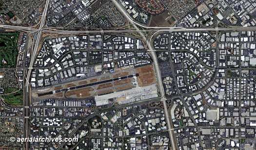
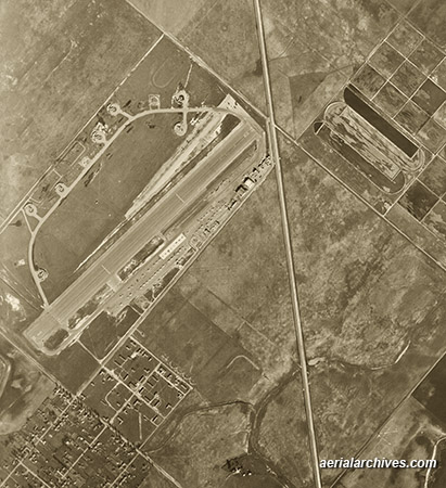
The aerial photo map of John Wayne Airport, Orange County, California shown above is available for immediate online license or prints or, to obtain it optimized to your needs please contact Aerial Archives
directly and reference the ID number in the caption to the photograph.
|
|
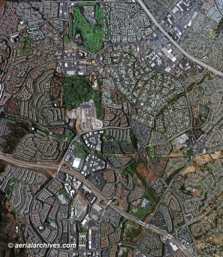
The aerial photo map of Laguna Hills, Orange County, California shown above is available for immediate online license or prints or, to obtain it optimized to your needs please contact Aerial Archives
directly and reference the ID number in the caption to the photograph.
|
|
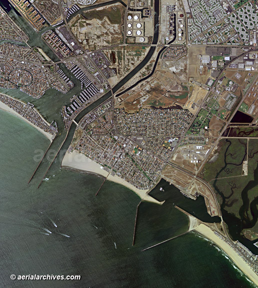
The aerial map of Seal Beach, Naples and Surfside in Orange County, California shown above is available for immediate online license or, to obtain a large file or this image optimized to your needs please
contact Aerial Archives
directly and reference the ID number in the caption to the photograph.
|
|
Aerial Archives also provides high resolution historical aerial photography for all portions of Orange County, California. This historical aerial map of Newport Beach shown above is available for immediate online license or prints or, to obtain a large file or this image optimized to your needs please
contact Aerial Archives
directly and reference the ID number in the caption to the photograph.
|
|
Historical aerial photography of Orange county dates back to 1927 for some portions of the county. A select number of historical aerial photographs of Orange County are available for immediate download or prints. For historical research of aerial photography and satellite imagery of Orange County, California we recommend that you use the research request form. Additional information about the process of researching historical aerial photography and satellite imagery for your location is available at aerial photography research. Oblique (at an angle) aerial photographs of Orange County are also available immediate download or prints. For current aerial photography and satellite imagery coverage of Orange County, California please contact us.
|