

Aerial Photo Maps of San Francisco, California
San Francisco Aerial Photo Maps For Immediate Download
Aerial Archives maintains an extensive library of vertical aerial photography and aerial maps of San Francisco, including current and historical aerial photography. Available imagery includes georeferenced aerial photography of San Francisco delivered both as digital files and prints. Aerial maps that are available include current aerial maps of the entire city and county of San Francisco and seamless aerial maps of the entire San Francisco bay area. Specialized services include delivery of geotiffs, customized labelling of aerial maps and output to specialized media. The aerial maps of San Francisco can also be completely customized to show precisely the scale and the area that you need covered. A selection of oblique (at an angle) aerial photographs of San Francisco is also available.
|
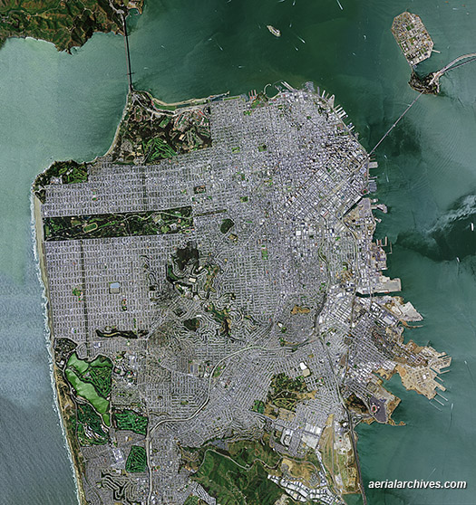
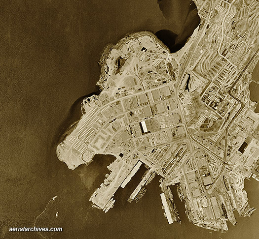
Aerial Photo Map of the City of San Francisco
|
Current aerial maps of the entire City and County of San Francisco are available for numerous years. In addition high resolution aerial maps both current and historical are available for San Francisco and the rest of the San Francisco bay area. The aerial photograph shown above from at full resolution could be enlarged to a width of 113". Aerial Archives also provides aerial maps showing the same area would enlarge up to a a height of 30 feet for the same area. Aerial Archives has produced a number of very large aerial murals for clients. A large aerial mural turns an office wall into a unique and powerful visual communications tool. The photograph below shows a small section of the larger view shown above. An aerial map of San Francisco, CA like the one shown above is available for immediate online license or prints, or to obtain this image optimized to your specific specifications please contact Aerial Archives directly. For the most recent aerial maps of San Francisco, please contact Aerial Archives directly. |
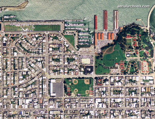
Aerial Map Showing Level of Detail in the Broad View Above
|
This aerial map gives an idea of the level of detail which is obtained from the view shown above at full resolution. One foot imagery which enables even more enlargement is also available. Aerial maps of this seamless imagery are available for the entire city and county of San Francisco, or for only a small area customized to your needs. |
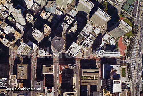
High Resolution Aerial Photo Maps of San Francisco
|
The aerial photo map of San Francisco, CA shown above is available for immediate online license or prints, or to obtain this image optimized to your specific specifications please contact Aerial Archives directly. To order a specific aerial map or aerial photograph of San Francisco, CA not shown on this site, for current vertical (straight down) aerial maps, please contact Aerial Archives directly. For historical aerial maps we recommend that you use the pdf research request form. Additional information about obtaining existing aerial photography is also available at aerial photography research and at aerial photography research FAQs. If an aerial photo map that will meet you needs is not available from the existing collection, Aerial Archives will create customize aerial photography, including very high resolution vertical aerial photography, for you. Additional information about custom flights is available at custom flights and at custom flight FAQs |
San Francisco Aerial Map Graphics
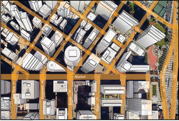
The illustration shown above is an example of the graphic services available in conjunction with our aerial map services. These graphics are available both from existing stock aerial photography and created from custom assignments. Aerial Archives also provides a full range of presentation, mounting and framing services.
|
Historical Aerial Photographs of San Francisco
Historical Aerial Photographs of San Francisco Available for Immediate Download
Aerial Archives provides in depth historical aerial photography and satellite coverage of the San Francisco bay area. For historical aerial photography of San Francisco we recommend that you use the pdf research request form. Additional information about obtaining existing aerial photography of San Francisco is also available at aerial photography research and at aerial photography research FAQs. To request a specific aerial map or aerial map graphic or presentation services please contact us. The historical aerial photo map of San Francisco, CA shown above is available for immediate online license or prints, or to obtain this image optimized to your specific specifications please contact Aerial Archives directly.
|