

Aerial Photographs of San Mateo County for Immediate Download
Historical Aerial Photographs of San Mateo County for Immediate Download
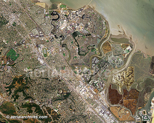
An extensive selection of vertical photography and and satellite imagery of San Mateo County, CA, including historical and current aerial photography is available from Aerial Archives. Available imagery includes georeferenced and orthorectified aerial photography and satellite imagery of San Mateo County delivered both as prints and in digital form. The collection includes seamless georeferenced aerial photography and satellite imagery of the entire county and seamless aerial maps of individual communities and geographic features in San Mateo County, including: Brisbane, Burlingame, Daly City, the Crystal Springs reservoir, Foster City, Half Moon bay, Hillsborough, Millbrae, Pacifica, Redwood Shores, Redwood City, the San Andreas fault, San Carlos, San Mateo, South San Francisco, San Bruno mountain and Woodside. Specialized services include delivery of geotiffs, customized labelling of aerial maps and output to specialized media. The area covered by an aerial map of San Mateo County can also be completely customized both with respect to scale and to show the entire city or metropolitan area or only a set of blocks.
The aerial map of San Mateo county, California shown above is available for immediate online license or prints, or to obtain this image at a larger file size suitable for very large displays, or optimized to your specific specifications please contact Aerial Archives directly. In addition to aerial maps and satellite imagery, Aerial Archives library contains oblique (at an angle) aerial photographs of San Mateo County. For current aerial photography and satellite imagery coverage of San Mateo County, California please contact us.
|
Historical Aerial Photographs of San Mateo County for Immediate Download
|
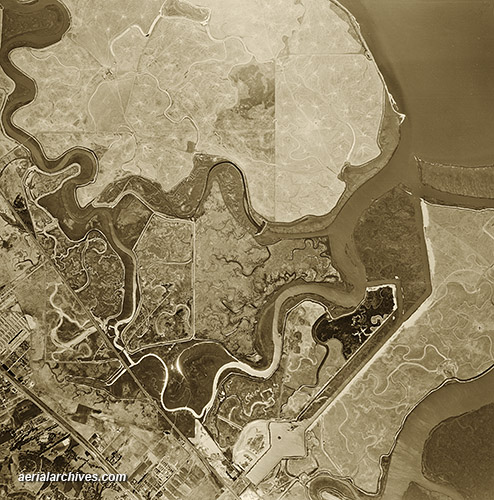
Historical aerial photographs of San Mateo county are available for numerous years.
The historical aerial photogarph of Foster City, California shown above is available for immediate online license or prints, or to obtain this image at a larger file size suitable for very large displays, or optimized to your specific specifications please contact Aerial Archives directly. For historical aerial photography of San Mateo county, we recommend that you use the pdf research request form. Additional information about obtaining historical aerial photography of San Mateo County is also available at aerial photography research and at aerial photography research FAQs. For additional information about aerial photography of San Mateo county, please contact us.
|