

Aerial Photography of Anchorage, Alaska
Aerials Photographs and Maps of Anchorage and Vicinity Available for Immediate License
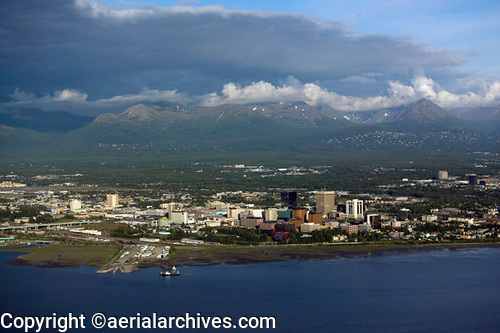
| A broad and diverse selection of stock aerial photographs of Anchorage, Alaska is represented in the aerial photography library of Aerial Archives. This includes oblique aerial photographs of Anchorage including aerial views of downtown Anchorage, the Ted Stevens Anchorage international airport, Merrill Field, the Cook inlet, the Port of Anchorage, and the individual Anchorage neighborhoods freeways, buildings and geographic features. The archive also contains a large collection of historical stock aerial photography of Anchorage, and a comprehensive collection of vertical Anchorage aerial photographs, and includes aerial photos of Anchorage area in color and black and white, with coverage approximately every ten years.
To order a specific stock aerial photograph of Anchorage, Alaska not shown on this site, please use the pdf research request form. Additional information about obtaining stock aerial photography is also available at aerial photography research and at aerial photography research FAQs. |