Aerial and Satellite Photography of Beijing, China
| Current and historical satellite imagery and aerial photography of Beijing, China and other portions of China is available from Aerial Archives. This includes current satellite imagery and historical aerial photographs of Beijing, China including aerial views of downtown Beijing, China, the University, the airport, and the major bridges, roads and geographic features and important architecture and parks.
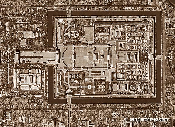
Included in this collection of aerial photography of China are aerial photographs of Tiananmen Square, the Forbidden City, the layout of the city during the 1960s. The archive also contains a large collection of historical stock aerial photography of Beijing, China, including a comprehensive collection of vertical Beijing, China aerial photographs and satellite photography. The historical aerial photograph of Tianenmen Square in Beijing shown above is available for immediate online license or prints, or to obtain this image optimized to your specific specifications please contact Aerial Archives directly.
To request research of a specific stock aerial photograph or satellite photograph of Beijing, China, not shown on this site, please use the pdf research request form. Additional information about obtaining stock aerial photography is also available at aerial photography research and at aerial photography research FAQs. |