

Aerial Photographs of Miami, Florida
Aerials Photographs of Miami Available for Immediate License
|
An extensive selection of aerial photographs and aerial maps of Miami, Florida is represented in the aerial photography library of Aerial Archives. To view thumbnails of aerial photographs of Miami available for immediate online license or prints, please consult Miami aerials photographs.
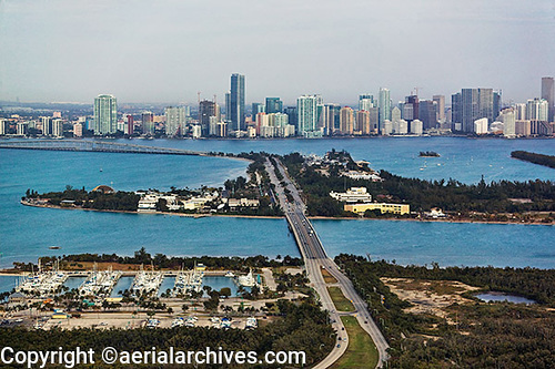
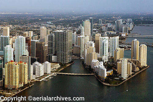
This aerial photography collection includes oblique aerial photographs of Miami, Florida, including aerial views of downtown Miami, Miami beach, south beach, the Port of Miami and the islands in Biscayne Bay and other communities in the vicinity of Miami. Also available are numerous aerial photographs of the individual buildings in downtown Miami, Florida. The collection also includes aerial photographs of the major Miami freeways and other Miami urban and geographical features. The aerial photograph of the downtown Miami skyline and Biscayne bay shown on this page is available for immediate online license or prints or to obtain this image optimized to your specific specifications please contact Aerial Archives directly.
|
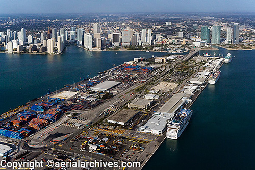
Aerial photographs of the Port of Miami, Biscayne Bay, Florida
|
The aerial photograph of Port of Miami, Dodge Island, Biscayne Bay, Florida shown above is available for immediate online license or prints, or to obtain this image optimized to your specific specifications please contact Aerial Archives directly.
|
|
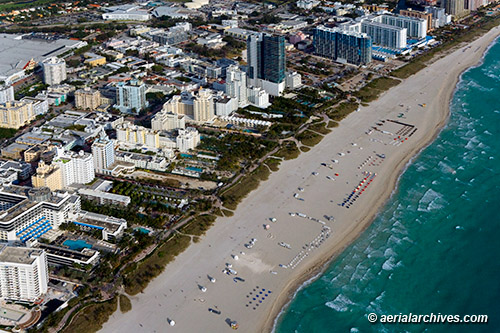
The aerial photograph of South Beach, Miami Beach, Florida shown above is available for immediate online license or prints, or to obtain this image optimized to your specific specifications please contact Aerial Archives directly.
|
|
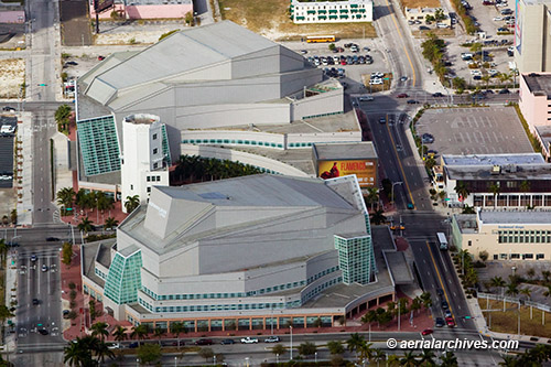
The aerial photograph of the Adrienne Arsht Center for the Performing Arts, Miami, Florida shown above is available for immediate online license or prints, or to obtain this image optimized to your specific specifications please contact Aerial Archives directly.
|
|
The aerial photograph of downtown Miami, Florida shown above is available for immediate online license or prints, or to obtain this image optimized to your specific specifications please contact Aerial Archives directly.
|
|
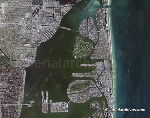
The archive also contains a comprehensive collection of vertical aerial photographs of Miami and the surrounding area as well as aerial maps of the rest of Florida and historical vertical aerial photography of Florida. The aerial map of the Miami skyline shown above is available for immediate online license or prints, or to obtain this image optimized to your specific specifications please contact Aerial Archives directly.
To order a specific aerial photograph of Miami, Florida not shown on this site or to obtain one of the photographs shown above optimized to your specific specifications, please contact us. For historical aerial photography of Miami we recommend that you use the pdf research request form. Additional information is available at historical aerial photography of Miami. Additional information about obtaining existing aerial photography of Miami is also available at aerial photography research and at aerial photography research FAQs.
For aerial photographs of the Everglades, Tampa or Orlando, Florida please consult
|