

Aerial Photography of Oakland, CA
Oakland Aerial Photographs For Immediate Download
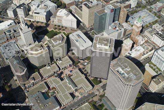
| Aerial Archives creates custom aerial photography of Oakland, California on assignment and its library contains an extensive selection of aerial photographs of Oakland, California. To view aerial photographs of Oakland available for immediate online license or prints, please consult Oakland aerial photographs. This collection includes oblique aerial photographs of Oakland including aerial views of downtown Oakland, Frank Ozawa park, the Oakland airport, the Oakland estuary, the Oakland harbor, the Oakland hills, and the major bridges, freeways, buildings and geographic features. Also available are numerous stock aerial photographs of Jack London Square, Lake Merritt, Oakland coliseum, the Port of Oakland, the Oakland zoo, the Tribune Tower and the San Francisco Oakland Bay Bridge and aerial photos of the construction of the San Francisco Oakland Bay Bridge. Also included are numerous aerial photographs of the freeway corridors of interstate 880, I-880, interstate 980, I-980, interstate 580, I-580 and highway 24, aerial photographs of the major freeway and highway interchanges, and a number of aerial views from Oakland toward San Francisco. The archive also contains a large collection of historical stock aerial photography of Oakland, beginning in the 1930s, and a comprehensive collection of current and historical vertical aerial photography of Oakland. For additional information about vertical aerial photography of Oakland, please consult Aerial Maps of Oakland. The aerial photograph of downtown Oakland, CA including the Tribune Tower and Broadway shown above is available for immediate online license or prints, or to obtain this image optimized to your specifications, please contact Aerial Archives directly.
|
Aerial Overviews of Oakland and Lake Merritt
|
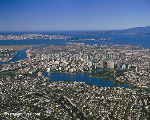
The Aerial Archives library contains numerous overviews of Oakland, CA. The aerial photograph of Lake Merritt, Oakland to San Francisco, CA shown above is available for immediate online license or prints, or to obtain this image optimized to your specification, please contact Aerial Archives directly.
|
|
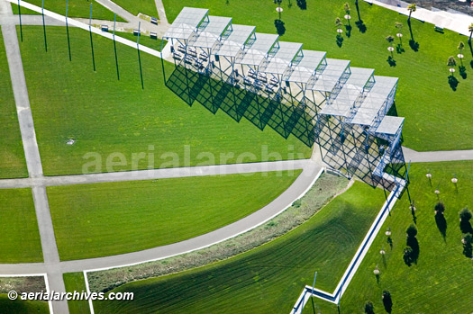
Contained in the Aerial Archives collection are aerial photographs of numerous parks in Oakland including the Oakland Middle Harbor Shoreline Park, the Martin Luther King Jr Shoreline Park, Snow Park at Lake Merritt and Frank Ozawa park. The aerial photograph of Point Arnold, Oakland Middle Harbor Shoreline Park in Oakland, CA shown above is available for immediate online license or prints, or to obtain this image optimized to your specifications, please contact Aerial Archives directly.
|
|
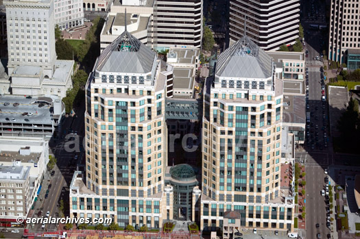
The Aerial Archives library also contains numerous aerial photographs of Oakland's architecture including detailed aerial photographs of the important individual buildings in Oakland, CA. The aerial photograph of the Federal Towers in Oakland, CA shown above is available for immediate online license or prints, or to obtain this image optimized to your specifications, please contact Aerial Archives directly.
|
Aerial Photographs of Oakland Coliseum For Immediate Download
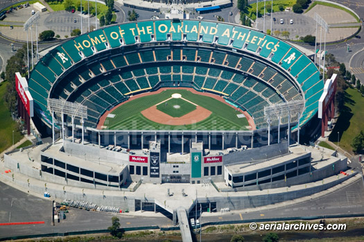
|
The Aerial Archives library contains numerous aerial photographs of the Oakland Coliseum including aerial photographs of tailgating prior to games, night time aerial photographs of the Oakland Coliseum during the Rolling Stones bridges to Babylon Tour, traffic on I-880 backed up because of an event taking place at the Oakland Coliseum and numerous other aerial photographs of the Oakland Coliseum. The aerial photograph of the Oakland Coliseum in Oakland, CA shown above is available for immediate online license or prints, or to obtain this image optimized to your specifications, please contact Aerial Archives directly.
|
Aerial Photographs of the Oakland Airport For Immediate Download
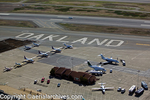
|
The Aerial Archives library contains numerous aerial photographs of the Oakland international airport including aerial photographs of both the general aviation and commercial terminal areas and runways, and overviews of Oakland in its relationship to San Francisco, Oakland and San Francisco bay. The aerial photograph of the Oakland airport (OAK) in Oakland, CA shown above is available for immediate online license or prints, or to obtain this image optimized to your specification, please contact Aerial Archives directly.
For custom aerial photography of Oakland or to obtain a specific stock aerial photograph of Oakland, CA not shown on this site, please contact Aerial Archives. For historical aerial photography we recommend that you use theresearch request form. For historical Oakland aerial photography available for immediate download or prints, please visit historical aerial photography of Oakland. Additional information about obtaining existing aerial photography is also available at aerial photography research and at aerial photography research FAQs.
|