

Aerial Photographs of San Jose, California
San Jose Aerial Photography For Immediate Download
Aerial Archives creates custom aerial photography of San Jose, California and its library contains an extensive selection of aerial photographs of San Jose, California in Santa Clara county. To view thumbnails of aerial photographs of San Jose available for immediate online license, please consult aerial photographs of San Jose.
This aerial photography collection includes oblique aerial photographs of San Jose, CA, including aerial views of downtown San Jose, the Mineta San Jose international airport, the surrounding communities and major geographic features and freeways including the golf courses, parks, hospitals and major downtown streets. Also available are numerous aerials of the individual buildings in downtown San Jose.
Aerial Photograph of San Jose, CA from the Southeast
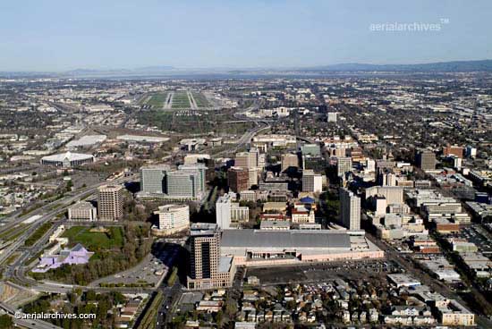
Aerial photograph of downtown San Jose
With Mineta San Jose International Airport
in Background
San Jose, California
Image ID: AHLB2099
© Herb Lingl/aerialarchives.com
Terms of Image Use |
Immediate License or Prints
Feedback
|
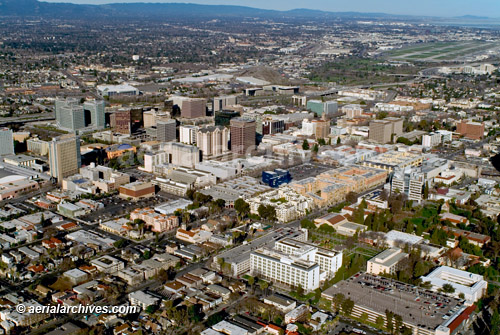
The aerial photograph of San Jose, California shown above is available for immediate online license or, to obtain it optimized to your needs please contact Aerial Archives directly and reference the ID number in the caption to the photograph.
The archive also contains a comprehensive collection of vertical aerial photographs of San Jose and aerial maps of San Jose, including aerial photos of the San Jose area both in color and black and white.
|
|
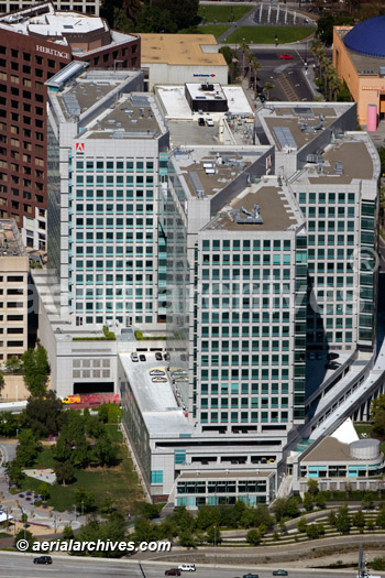
The aerial photograph of Adobe Systems corporate headquarters in San Jose, California shown above is available for immediate online license or, to obtain it optimized to your needs please contact Aerial Archives directly and reference the ID number in the caption to the photograph.
|
|
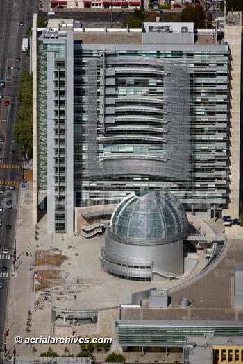
The aerial photograph of San Jose City Hall shown above is available for immediate online license or, to obtain it optimized to your needs please contact Aerial Archives directly and reference the ID number in the caption to the photograph.
|
|
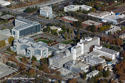
The aerial photograph of Santa Clara Valley Medical Center in San Jose, California shown above is available for immediate online license or, to obtain it optimized to your needs please contact Aerial Archives directly and reference the ID number in the caption to the photograph.
For custom aerial photography of San Jose or to obtain a specific aerial photograph of San Jose, CA not shown on this site, please contact us. For historical aerial photography of San Jose, we recommend that you use the pdf research request form. Additional information about obtaining existing aerial photography is also available at aerial photography research and at aerial photography research FAQs.
|