

Aerial Photographs of San Jose for Immediate Download
Aerial Photographs of Santa Clara County for Immediate Download
An extensive selection of aerial photographs of Santa Clara county in California is represented in the library of Aerial Archives. This includes oblique aerials of all of Santa Clara county including views of each of the individual cities and townships of Santa Clara county.
Among the cities and communities in this collection of aerial photography of Santa Clara county are aerial photographs of
Alviso,
Cupertino,
Los Altos,
Los Altos hills,
Menlo Park,
Milpitas,
Moffett Field
the Mount Hamilton observatory,
Mountain View
Palo Alto,
San Jose,
Santa Clara,
Stanford University,
Gilroy, and
Sunnyvale.
The archive also contains a comprehensive collection of vertical Santa Clara County aerials including aerial photos of Santa Clara County both in color and black and white. For additional information please visit Aerial Photo Maps of Santa Clara County.
The aerial photograph of San Jose, CA shown on this page is available for immediate online license or prints.
For current aerial photography coverage of Santa Clara county, California please contact us.
To order a historical aerial photograph of Santa Clara county not shown on this site, please use the
pdf research request form.
Additional information about obtaining existing aerial photography is also available at
aerial photography research
and at
aerial photography research FAQs.
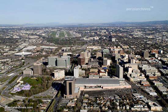
Aerial photograph of downtown San Jose, California
Image ID: AHLB2099
© Herb Lingl/aerialarchives.com
Terms of Image Use |
Immediate License or Prints
Feedback