

Aerial Photographs of the Pacific Coast for Immediate Download
|
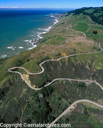
An excellent selection of aerial photographs of Pacific coast is represented in the library of Aerial Archives. This includes comprehensive oblique aerial photography coverage of the entire Pacific coast, including aerial views of each of geographic and geological features. This aerial photography collection features aerial photographs of the California coastline, including curvy sections of Highway One, hilly portions of Pacific coast, serpentine and winding roadways, the Sonoma coast, Marin coastline and Mendocino coastline and some of the steepest portions of the Pacific coast.The archive also contains a comprehensive collection of vertical Pacific coast aerials including aerial photos of Pacific coast both in color and black and white. The aerial photograph of the Pacific Coast in Sonoma County, CA shown on this page is available for immediate online license or prints. Aerial Archives will also deliver this image optimized to your specific specifications either as a digital file on CD, DVD or via the internet, or as a print, aerial mural, transparency or backlit display. To obtain customized service, please contact Aerial Archives directly.
To order a specific stock aerial photograph of the Pacific coast not shown on this site, please use the pdf research request form. Additional information about obtaining stock aerial photography is also available at aerial photography research and at aerial photography research FAQs. |