

|
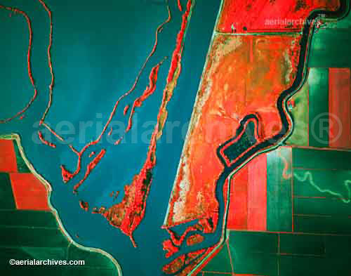
Aerial Archives has available a comprehensive library of aerial photography and aerial maps of the Sacramento-San Joaquin river delta and is available to create custom aerial photography and aerial videography. For a thumbnail index of oblique aerial photography of Sacramento-San Joaquin river delta which can be viewed on line, please consult the Sacramento-San Joaquin river delta aerial photography index. Large vertical aerial photographs or aerial maps of the delta from vertical imagery are also available. Murals of the delta sized up to 25 feet across with exceptional detail are available. Georeferenced aerial photography of the entire Sacramento river delta is also available for numerous years customized to many different projections. For additional information please consult Aerial Maps of the Delta. Available as stock aerials include many aerial photographs of the Sacramento San Joaquin river delta in California, including historic aerials of the delta, infrared aerial photographs and aerial maps of the delta and a large archive of current aerial photography of the Sacramento San Joaquin river delta. The aerial photography archive also includes numerous very detailed oblique and vertical aerial photographs, including detailed views of wetland features, levees, specific islands and submerged islands in the delta, infrared sedimination and flow patterns. Also available are aerial photographs the towns along the Sacramento San Joaquin river delta as well as agriculture, bridges, commercial real estate, environmental subjects, wetlands, geographic features, airports, ports, harbors and marinas and numerous additional categories. Specialized categories are also contained in the archive including an extensive collection of both oblique and vertical infrared aerial photographs of the Sacramento San Joaquin river delta showing levees, vegitation and sediment flows in various portions of the delta and at many of the major submerged islands.
|
|
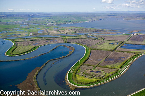
This stock aerial photograph of Quimby Island, levees, Franks Tract in background, Sacramento San Joaquin river delta is available for
or immediate online license or prints or, to obtain this aerial photograph optimized to your specifications, please contact Aerial Archives directly.
|
|
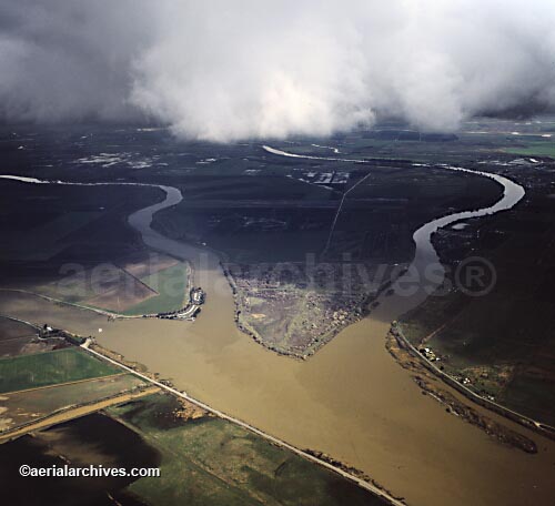
The aerial photograph of the sloughs in the Sacramento San Joaquin river delta shown above is available for immediate online license or, to obtain it optimized to your needs please contact Aerial Archives
directly and reference the ID number in the caption to the photograph. For specific requests for Sacramento river delta aerial photos, delta aerial maps and aerial images of other portions of the Sacramento river delta, please use the pdf research request form. Additional information about obtaining stock aerial photography is also available at aerial photography research and at aerial photography research FAQs. If the aerial photograph you are seeking is not available in archives, Aerial Archives is also equipped to quickly obtain precisely the view you need, including spot vertical aerial photographs, oblique aerial photographs and infrared aerials and aerial video. Aircraft and helicopters specifically equipped for aerial photography and aerial video missions are available, and pilots working with Aerial Archives are specifically trained to ensure each photography or film mission delivers the highest quality imagery attainable. We are experienced in shooting on film and digital media. Please let us know how we can help you acquire the imagery you need.
|