

Aerial Photography of Erosion
Aerial Photographs of Erosion For Immediate Download
|
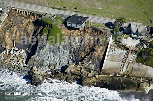
Aerial Archives collection includes a number of aerial images of erosion, including aerial photographs of erosion and endangered houses along the Pacific Coast. To aerial photographs of erosion available for immediate online license or prints, please consult aerial photographs of erosion.
Vertical aerial photography and satellite imagery documenting erosion is also available from Aerial Archives. The aerial photograph of erosion of the Sonoma County California Pacific coastline shown above is available for immediate online license or prints, or to obtain this image optimized to your specification, please contact Aerial Archives directly.
|
Aerial Maps and Satellite Imagery of Erosion
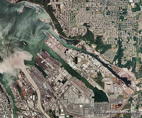
Aerial maps (vertical aerial photography) and satellite imagery are also particularly useful in documenting erosion. Historical vertical aerial photography can effectively show the effects of erosion over time. The aerial map of the Port of Tacoma showing sediment flowing into Commecement Bay and Pudget Sound from the Puyallup river shown above is available for immediate online license or prints, or to obtain this image optimized to your specification, please contact Aerial Archives directly. |
Aerial Photographs of Rivers Carrying Eroded Sediment
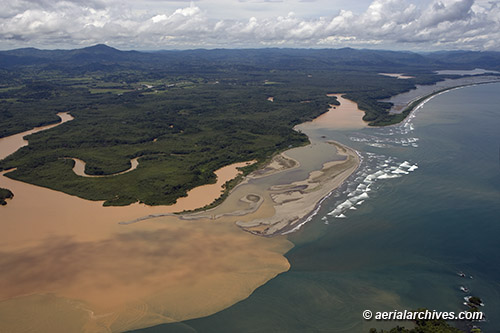
The aerial photograph of eroded sediment being carried into the Pacific Ocean by a river in Panama shown above is available for immediate online license or prints, or to obtain this image optimized to your specification, please contact Aerial Archives directly.
|
Aerial Photographs of Eroding Cliffs at Devil's Slide California
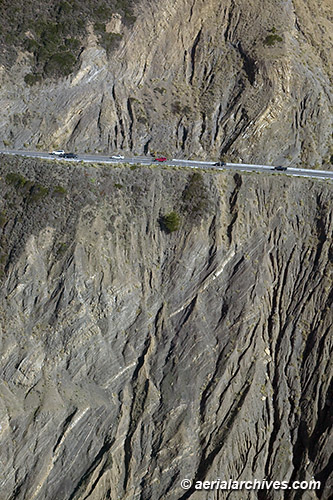
The aerial photograph of the eroding cliffs at Devil's Slide along the Pacific Coast in San Mateo County California shown above is available for immediate online license or prints, or to obtain this image optimized to your specification, please contact Aerial Archives directly.
To obtain a specific stock aerial photograph of erosion not shown on this site, please contact us. For historical research of aerial photography or satellite imagery documenting erosion we recommend that you use the research request form. Additional information about obtaining stock aerial photography is also available at aerial photography research and at aerial photography research FAQs.
|